Earth Sciences Division
Sciences and Exploration Directorate - NASA's Goddard Space Flight Center

Chesapeake Bay Working Group

Chesapeake Bay

Interagency Workshop on Societal Applications of Satellite Data for the Chesapeake Bay

8.7.2018

This one-day interagency workshop was focused on current applications and future opportunities for satellite data and products to support decision making around the Chesapeake Bay in the context of coastal and inland aquatic ecosystems and water quality. An interactive format welcomed representatives from a broad range of backgrounds to provide unique perspectives on aquatic data needs, including middle agency providers of data, policy analysts and businesses.

Download workshop presentations from table below

Introductions and Overview
Welcome and Workshop Overview Stephanie Schollaert Uz (NASA)
Plankton, Aerosol, Cloud, ocean Ecosystem (PACE) Overview Antonio Mannino (NASA)
Next Generation Space-borne Aquatic Sensor Kevin Turpie (NASA/UMBC)
Panel 1: Quantifying Ecology
Water Clarity Assessments Mark Trice (Maryland DNR)
Fingerprints of the Chesapeake: An intuitive, simple, and effective optical fingerprinting tool for coastal monitoring Ryan Vandermeulen (NASA/SSAI)
Microbial Biodiversity in the Chesapeake Bay Grace Kim (NASA/USRA)
Ecosystem Service Valuation for Regulatory Analysis Chris Moore (EPA)
Panel 2: Human Health
Harmful Algal Blooms Rick Stumpf (NOAA)
MDE Shellfish Monitoring John 'Rusty' McKay (MDE)
Tracking Clinically Active Vibrios Using Earth Observations Antar Jutla (WVU)
Demonstration
Overview of Ocean Color Data Access and Analysis Tools Amita Mehta (NASA/UMBC/JCET)
Panel 3: Land-Water Interaction
Opportunities for Collaboration: Select Data Needs for the Chesapeake Bay Program Partnership Peter Tango (USGS)
NRL Research in Remote Sensing of Coastal Water Column and Bottom Characteristics Wes Moses (NRL)
The National Wetlands Inventory: Mapping and Monitoring in the Chesapeake Bay Watershed Megan Lang (FWS)
Terrestrial Nurient and Sediment Sources Peter Claggett (USGS)
Keynote Presentation
Ecology of Vibrios and Satellite Remote Sensing: A Bizarre Thought, but Exciting Progress Anwar Huq with Rita Colwell (UMD)


Chesapeake Bay Workshop Attendees

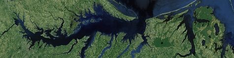
Workshop participants gather around a Landsat 8 image of the Chesapeake Bay. Click for full size image. (Credit: NASA/Andrea Portier)


Landsat 8 Image of the Chesapeake Bay

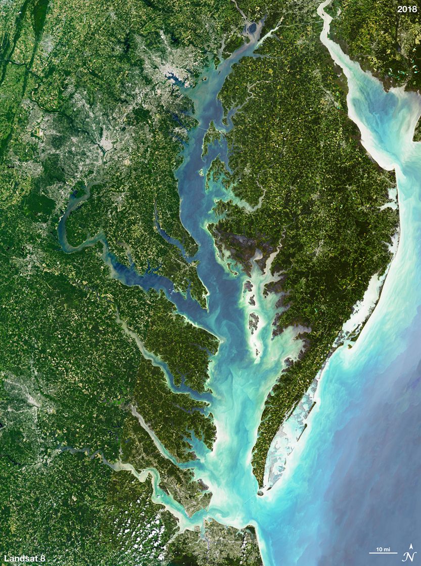
Image of the Chesapeake Bay acquired by Landsat 8. (Credit: NASA/Michael P. Taylor/Ginger Butcher)


Overview

Working Groups

Partnerships

Seminar Series

Related NASA Programs

Contacts

Stephanie Uz
Applied Sciences Manager
stephanie.uz@nasa.gov
301.286.0549

Brendan McAndrew
Applied Sciences Coordinator
brendan.b.mcandrew@nasa.gov
301.286.3992