Disasters
Highlights
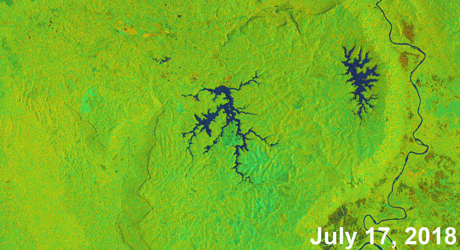
Goddard Scientists Deploy Damage Assessment Tool in Laos Flood Relief Efforts
 Credits: NASA Disasters/Marshall Space Flight Center/Alaska Satellite Facility; contains modified Copernicus Sentinel data (2018) processed by ESA
On July 23, 2018 the Xepian-Xe Nam Noy hydropower dam in southern Laos failed and released
more than 130 billion gallons of water on rural villages downstream. Thousands of houses and businesses were destroyed
and over 6,000 people were displaced. The Sentinel-1 satellite from the European Space Agency (ESA) Copernicus
program observed the area surrounding the Xepian-Xe Nam Noy dam in Laos before (July 17, 2018) and after (July 25, 2018) the
dam’s July 23, 2018, failure. The reduction in size of the reservoir behind the dam is visible in the before-and-after images
above.
NASA researchers John Bolten and Perry Oddo and Stanford University researcher Aakash Ahamed recently developed a system that predicts flood damage based on satellite and ground data. The model estimates floodwater depth, adds information about land use and building infrastructure, and generates a dollar-value calculation of the damage in the target area. Learn more about the model here and here.
Global Fire Weather Database
The Global Fire Weather Database (GFWED) contains daily global fire danger ratings from 1980 to present day. The ratings contained in this dataset are calculated according to the Canadian Forest Fire Weather Index (FWI) System using weather data from NASA's MERRA-2, GEOS-5, and GPM IMERG datasets. More information about the development of this database can be found here.
Disasters Resources
Visit the NASA Earth Science Disasters Program page.
Overview
The Disasters Group aims to link GSFC scientists with cross-agency and inter-agency projects on disaster response, risk reduction and resilience efforts.
Thematic Areas
- Air Quality and Health
- Chesapeake Bay
- Climate and Environmental Health
- Disasters
- Food Security
- Mission Applications