Your Page Title
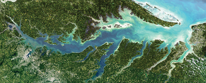
Chesapeake Bay Water Quality Modeling Workshop
Combining Current or Future Satellite Data with Models to Solve Practical Societal Problems
8.22.2019
This one-day workshop, held at Goddard Space Flight Center, connected researchers with resource managers and stakeholders to support decision making around Chesapeake Bay water quality and ecosystem health. This workshop identified state-of-the-art modeling, especially where relevant satellite data sets are used. There were panel discussions on water clarity and harmful algal blooms and during the discussion sessions, action items were developed to focus on these key areas and to outline next steps to further interagency and academic efforts.
| Welcome and Overview | |
|---|---|
| Background and Overview | Stephanie Schollaert Uz (NASA) |
| Aquaculture in the Northern Chesapeake Bay | Scott Budden (Orchard Point Oyster Co) |
| How can satellite information improve these models? | Marjy Friedrichs (VA Institute of Marine Science) |
| Panel 1: Water Clarity - Moderated by Carl Friedrichs (VIMS) | |
| Rusty McKay (Maryland Department of Environment) | |
| Brooke Landry (MD Department of Natural Resources) | |
| Mark Trice (MD Department of Natural Resources) | |
| Dick Zimmerman (Old Dominion University) | |
| Panel 2: Harmful Algal Blooms - Moderated by Chris Brown (NOAA) | |
| Margaret Smigo (Virginia Department of Health) | |
| Shelly Tomlinson (NOAA) | |
| Antonio Mannino (NASA) | |
| Perspectives from Other Activities and Future Direction | |
| Future Directions in Chesapeake Bay Water Quality Modeling | Christa Peters-Lidard (NASA) |
| Ecological Forecasting and Future Directions | Woody Turner (NASA) |
| Machine Learning Algorithms for Satellite Remote Sensing of Water Quality in the Chesapeake Bay | Marvin Li, Greg Silsbe (UMCES) |
Additional supplementary resources for getting started with Satellite Data:
Visit our 2018 Workshop page