Missions & Projects
For further mission information, data, research, and other resources, see Mesoscale Atmospheric Processes Projects.
Featured
Alphabetical
By Last Name:
Displaying records 1 to 24 of 37.
Show:
Applied Sciences
Connecting NASA researchers with interagency activities and partnerships to facilitate practical and innovative uses of Earth observations for societal benefit in six thematic areas: Air Quality and Health, Chesapeake Bay, Climate and Environmental Health, Disasters, Food Security, and Mission Applications.

Aqua
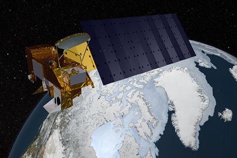
Aqua, Latin for water, is a NASA satellite mission designed to collect information about Earth's water cycle and other aspects of the Earth system. Aqua's six instruments collect a variety of global data on ocean evaporation, atmospheric water vapor, clouds, precipitation, soil moisture, sea ice, land ice, and snow cover on the land and ice. Additional variables that Aqua measures include radiative energy fluxes; aerosols; vegetation cover on the land; phytoplankton and dissolved organic matter in the oceans; and air, land, and water temperatures. Aqua was launched on May 4, 2002.
Key Staff
- Project Scientist: Lazaros Oreopoulos
- Deputy Project Scientist: Linette Boisvert
- Instrument Principal Investigator: Miguel Román
Atmospheric Lidar for Validation, Interagency Collaboration and Education (ALVICE)
ALVICE (Atmospheric Lidar for Validation, Interagency Collaboration and Education) is a ground based mobile lidar that is a roving transfer standard within the Network for the Detection for Atmospheric Composition Change (NDACC). The lidar measurements are water vapor mixing ratio, aerosol backscatter, extinction, depolarization, cloud liquid and ice water and rotational Raman temperature measurements. In addition to these lidar-based measurements additional equipment is carried in the trailer to provide balloon borne measurements (Vaisala RS-92 and Cryogenic Frostpoint hygrometer), surface reference measurements of pressure, temperature and RH as well as total column water using GPS.
Cloud Physics Lidar (CPL)
The Cloud Physics Lidar, or CPL, is a airborne backscatter lidar designed to operate simultaneously at three wavelengths: 1064, 532, and 355 nm. The CPL flies on high-altitude research aircraft, such as the ER-2 or WB-57. The purpose of the CPL is to provide multiwavelength measurements of cirrus, subvisual cirrus, and aerosols with high temporal and spatial resolution. The CPL utilizes state-of-art technology with a high repetition rate, low pulse energy laser and photon-counting detection. Vertical resolution of the CPL measurements is fixed at 30 m; horizontal resolution can vary but is typically about 200 m. From a fundamental measurement of 180-degree volume backscatter coefficients, various data products are derived, including time-height cross-section images; cloud and aerosol layer boundaries; optical depth for clouds, aerosol, and planetary boundary layer; and extinction profiles.
Cloud Radar System (CRS)
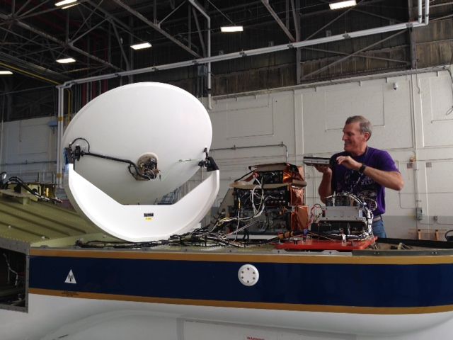
The CRS is a 94 GHz (W-band; 3 mm wavelength) Doppler radar developed for autonomous operation in the NASA ER-2 high-altitude aircraft and for ground-based operation. It provides high-resolution profiles of reflectivity and Doppler velocity in clouds and has important applications to atmospheric remote sensing studies. The CRS was designed to fly with the Cloud Lidar System (CLS) in the tail cone of an ER-2 superpod. It was upgraded from 2012 through 2014 to include a new solid-state transceiver with pulse compression, data system, digital receiver, antenna, and power supply.

Clouds and the Earth’s Radiant Energy System (CERES)
The Clouds and the Earth’s Radiant Energy System (CERES) project provides satellite-based observations of ERB and clouds. It uses measurements from CERES instruments flying on several satellites along with data from many other instruments to produce a comprehensive set of ERB data products for climate, weather and applied science research.
Compact Scanning Submillimeter-wave Imaging Radiometer (CoSSIR)
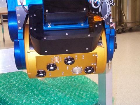
The Compact Scanning Submillimeter-wave Imaging Radiometer (CoSSIR) is an airborne, 12-channel, (183 - 874 GHz) total power imaging radiometer that was mainly developed for the measurements of ice clouds. But it can be used for estimation of water vapor profiles and snowfall rates. When first completed and flown in the CRYSTAL-FACE field campaign during July 2002, the system had 15 channels at different frequencies.
Conical Scanning Millimeter-wave Imaging Radiometer (CoSMIR)
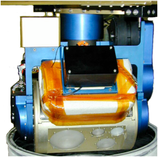
The Conical Scanning Millimeter-wave Imaging Radiometer (CoSMIR) instrument is an airborne, 9-channel total power radiometer originally developed to calibrate and validate the Special Sensor Microwave/Imager/Sounder (SSMIS) for the Defense Meteorological Satellite Project (DMSP) F-series satellites. CoSMIR has four receivers near 50, 91, 150, and 183 GHz which measure horizontally polarized radiation with vertically polarized measurement capability at 89.0 and 165.5 GHz. CoSMIR was flown for calibration/validation of the SSMIS in 2004-2005 off coastal California. Currently, CoSMIR has been modified to play the role as an airborne high-frequency simulator for the GPM Microwave Imager (GMI). The 9 channels of CoSMIR for GMI validation are at the frequencies of 50.3, 52.6, 89 (H & V), 165.5 (H & V), 183.3±1, 183.3±3, and 183.3±7 GHz. All channels besides 89 and 165.5 GHz will be horizontally polarized.
Disdrometer and Radar Observations of Precipitation facility (DROP)
Home based at Wallops Flight Facility (WFF), DROP provides ground-based measurements of hydrometeor properties including size, number concentration, shapes, fall speeds, and water contents for both liquid (e.g., rain) and frozen (e.g., snow) hydrometeors. DROP instrument assets include the following: 5 Two Dimensional Video Disdrometers (2DVDs), 24 Parsivel Disdrometers, >100 Tipping Bucket Raingauges, including a high density autonomous network being deployed on the Delmarva Peninsula, 3 Micro Rain Radars, 9 Pluvio weighing gauges, 7 Yankee Environmental Hot Plate sensors, and Snow Video Imagers. These assets are combined with WFF polarimetric radar assets (e.g, NPOL) measurements to provide detailed physical characteristics of precipitation in the atmospheric column.
Dual-frequency Dual-polarized Doppler Radar (D3R)
D3R is a transportable radar with the same frequencies as the GPM Core satellite Dual-frequency Precipitation Radar (DPR). It is used for assessing dual-frequency path integrated attenuation algorithms and quantifying rainfall rate, particle size distributions, water contents and precipitation type. It is especially useful for studying falling snow.
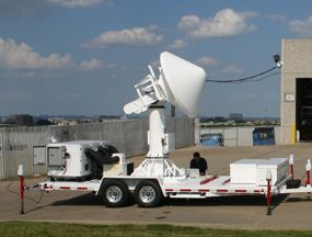
ER-2 X-band Doppler Radar (EXRAD)
ER-2 X-band Radar (EXRAD) was first flown in 2013 as a replacement to its predecessor, EDOP. EXRAD provides new capability with a conically scanning beam and a fixed nadir beam. EXRAD has flown on NASA's ER-2 and Global Hawk aircraft.

Geostationary Operational Environmental Satellite - R Series (GOES-R Series)
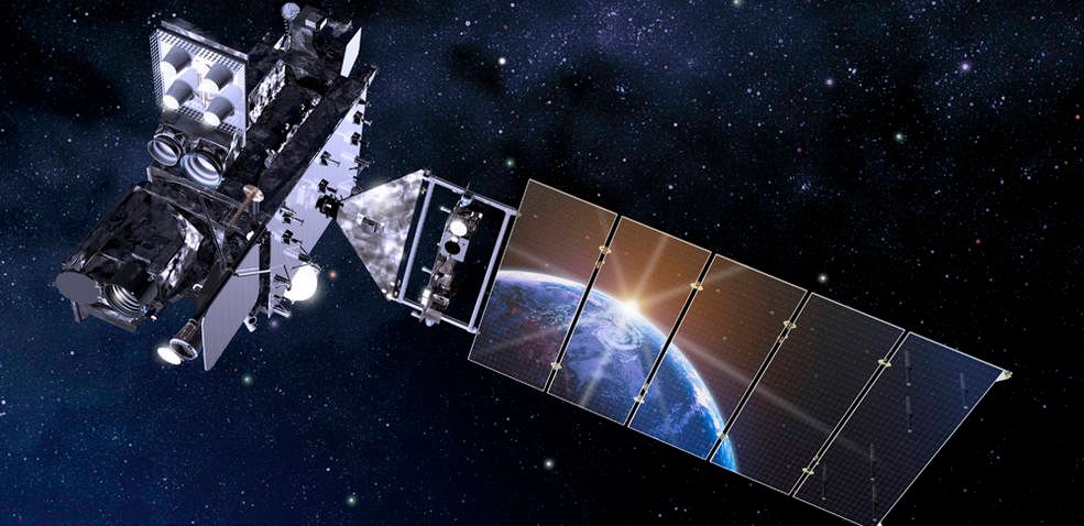
NOAA’s latest generation of Geostationary Operational Environmental Satellites (GOES), known as the GOES-R Series, is the nation’s most advanced fleet of geostationary weather satellites. The GOES-R Series significantly improves the detection and observation of environmental phenomena that directly affect public safety, protection of property and our nation’s economic health and prosperity.
The satellites provide advanced imaging with increased spatial resolution and faster coverage for more accurate forecasts, real-time mapping of lightning activity, and improved monitoring of solar activity and space weather.
The GOES-R Series is a four-satellite program [GOES-R (now 16)/S (now 17)/T (now 18)/U (now 19)] that will extend the availability of the operational GOES satellite system through 2036.
Geostationary Operational Environmental Satellites-NOP Series (GOES-NOP )
GOES is a series of satellites that provide a constant vigil for the atmospheric "triggers" for severe weather conditions such as tornadoes and hurricanes. GOES-P, the third spacecraft in the GOES-NOP Series of satellites, launched March 4, 2012 from Cape Canaveral Air Force Station in Florida.
Global Precipitation Measurement (GPM)
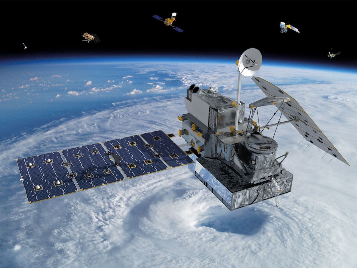
The GPM mission is one of the next generation of satellite-based Earth science missions that study global precipitation (rain, snow, ice). GPM Constellation is a joint mission with the Japan Aerospace Exploration Agency (JAXA) and other international partners. Building upon the success of the Tropical Rainfall Measuring Mission (TRMM), it initiates the measurement of global precipitation, a key climate factor. Its science objectives are: to improve ongoing efforts to predict climate by providing near-global measurement of precipitation, its distribution, and physical processes; to improve the accuracy of weather and precipitation forecasts through more accurate measurement of rain rates and latent heating; and to provide more frequent and complete sampling of the Earth's precipitation. GPM was launched February 27, 2014.
Key Staff
- Formal Education Specialist: Dorian Janney
- RESEARCH SCIENTIST: Andrea Portier
- Project Scientist: George Huffman
- Deputy Project Scientist: Erich Stocker
- Deputy Project Scientist: David Wolff
Goddard Cumulus Ensemble (GCE)
The Goddard Cumulus Ensemble (GCE) model, a cloud resolving model (CRM), has been developed and improved at NASA Goddard Space Flight Center over the past two decades. The development and main features of the GCE model were published in Tao and Simpson (1993) and Tao et al. (2003b). A review of the applications of the GCE model to develop a better understanding of precipitation processes can be found in Simpson and Tao (1993) and Tao (2003). The 3D version of the GCE model is typically run using 256 x 256 up to 1024 x 1024 horizontal grid points at 1-2 km resolution or better. An MPI version of the GCE model was recently developed (Juang et al. 2006). It is well documented and easy to modify and improve. It is also flexible enough to run on many different platforms using any number of CPUs.
Goddard Lidar Observatory for Wind (GLOW)
It is a mobile Doppler lidar system based on double edge direct detection technology. It consists of a molecular system at 355nm and a aerosol system at 1064nm. GLOW merges atmospheric science with innovative new remote sensing methodologies. New lidar technologies are perfected during ground use in preparation for eventual use in air and space based wind measurement systems.
Goddard Satellite Data Simulator Unit (G-SDSU)
The G-SDSU is the end-to-end satellite simulator unit, which can compute satellite-consistent Level-1 (L1) measurements (radiance/brightness temperature or backscatter) from the output of meso- or cloud-scale model simulations through passive microwave simulator, radar simulator, passive visible-IR simulator, LIDAR simulator, and broadband simulator through rigorous satellite orbit and scan geometry simulations. The G-SDSU has been coupled with various NASA high-resolution atmospheric model outputs, such as the NASA-Unified Weather Research and Forecasting (NU-WRF) model, the WRF with the Spectra Bin Microphysics (WRF-SBM), the Goddard Cumulus Ensemble (GCE) model, and the NASA Multi-Scale Modeling Framework (MMF), and the Goddard Earth Observing System 5 (GEOS5) via NetCDF format.
.jpg)
High Altitude Radar (HAR)
The high-altitude airborne radar group at NASA Goddard Space Flight Center covers all aspects of high-altitude airborne Doppler radars from hardware development, deployment, processing, and performing science studies with the data. They have participated in NASA field campaigns for over 20 years with focus on hurricanes and convection, TRMM, GPM, and CloudSat validation, and more recently snow storms. Several aircraft used for these studies including the NASA ER-2, WB-57, and Global Hawk.
High Altitude Wind and Rain Profiling Radar (HIWRAP)
The High Altitude Wind and Rain Profiling Radar (HIWRAP) is a dual-frequency (Ka- and Ku-band), dual-beam (30 and 40 degree incidence angle), conical scan, solid-state transmitter-based system, designed for operation on the high-altitude (20 km) Global Hawk UAV.

Holographic Airborne Rotating Lidar Instrument Experiment (HARLIE)
The HARLIE transceiver is based on a volume phase holographic optical elements (HOE) made in dichromated gelatin (DCG) sandwiched between 2 layers of high quality float glass. It demonstrates the practical application of this technology to a compact scanning lidar system at 1064 nm wavelength. The HOE has the ability to withstand moderately high laser power and energy loading and is of sufficient optical quality for most direct detection systems,and overall efficiency rivaling conventional receivers. It's size and weight are approximately half of similar performing scanning systems using reflective optics.
