Early Career Scientist Spotlight
Dr. Robert Emberson (he/him/his)
Geomorphologist
Hydrological Sciences Laboratory (617)
What inspired you to pursue a career in geomorphology?
I’ve been interested in science for as long as I remember. My parents reminded me recently of the sheer joy I had as a 10-year-old when I found the Galilean moons of Jupiter through a tiny telescope – I have always been fascinated in understanding how the world works. The processes that govern how the surface of Earth looks are particularly fascinating to me, since they set the boundaries for all of the landscapes we find most magical, from mountains to deserts to jungles. I was lucky to be involved in a lot of fieldwork as part of undergraduate earth science courses, and that really helped link what I was taught in class with what was happening beneath my feet. My main focus right now is on natural disasters and in particular erosional processes like landslides, and I think much of the inspiration comes from seeing the impact that Earth surface processes have on humans – the better we understand and model these systems, the better we can live in harmony with them.
How did you end up working at NASA Goddard?
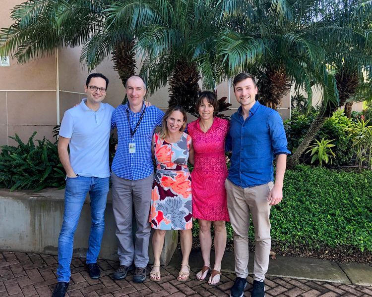
While I found my PhD research interesting, I was searching for projects that were more relevant to the problems facing humans in the 21st century. As a result, after completing my PhD, I spent some time working adjacent to academia – for a short time I was an editor for Nature Geoscience, and I also worked as a science communicator. I was aware of the NASA Postdoctoral Program for a few years before I eventually applied, but it was only when I saw a project opportunity to work in Dr. Dalia Kirschbaum’s landslide group at NASA Goddard Space Flight Center (GSFC) that I thought I could really put my skills to work on a project that would have real societal benefit – developing landslide exposure assessments. Dalia has been a fantastic mentor and guide for how to do good science and use it to benefit stakeholders around the world – I think that was instrumental in attracting me to Goddard.
Credit: Dalia Kirschbaum, GSFC
What is your research focus?
I actually have a bunch of different projects and roles right now. My current research has two main areas. The first project is focused on the erosion of agricultural soil. Soil erosion, driven by intense rainfall, is a real threat to food security around the world, but our existing global models are static and don’t provide a great deal of utility for seasonal planning of erosion mitigation measures. I use a range of satellite observations, including NASA’s Global Precipitation Measurement (GPM) rainfall data, Moderate Resolution Imaging Spectroradiometer (MODIS) and Landsat land cover classification, and water quality observations from Sentinel-2, to model month-to-month changes in soil erosion and to compare those changes with observations of water quality in large reservoirs, where much of the eroded material ends up.
Alongside this work, I also lead research to test whether the Global Modeling and Assimilation Office’s (GMAO) seasonal-to-subseasonal (S2S) forecasts can be used to predict potential for extreme rainfall with months of lead-time. This work is still at an early stage but it’s been interesting to test how a diverse set of potential proxies for extreme rainfall like forecasts of atmospheric humidity are linked to Integrated Multi-satellitE Retrievals for GPM (IMERG) rainfall observations, especially when medium term climatic oscillations like El Niño are factored in.
For the other half of my time, I’m one of the Associate Program Managers for the Disasters Program, where I get to experience how NASA projects are organized and supported from headquarters. This is a very diverse position – alongside the management of projects and communication of funded PIs’ key results to senior leadership, I’ve also been co-leading the program’s disaster response activities for the last year. The team of coordinators across NASA provide data and analysis for groups like the Federal Emergency Management Agency (FEMA) and the World Food Program to inform decisions made before, during and after disasters. It’s really rewarding, and I’ve also been able to support the development of the soon-to-be-launched Disaster Response Coordination System, learning from experts and leaders from across NASA to improve our support for response stakeholders.
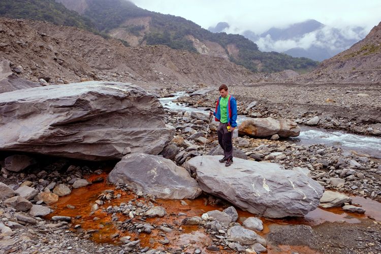
Credit: Niels Hovius, GFZ Potsdam
What is one of your favorite moments in your career so far?
In 2019, I was involved in a project to provide landslide hazard and exposure analysis for the Rohingya refugee camps in Southern Bangladesh, where around a million displaced people live. I worked to apply methods developed at a regional scale to the more localized setting of the refugee camps, coordinating with local stakeholders to use higher resolution data to provide a map of landslide hazards at the building scale to help the camp managers. I was able to visit the camps to help provide training on methods to disaster response stakeholders there, and it definitely drove home the value of using science to help inform humanitarian decisions. A really great moment came a few months later, when I found out from partners with whom I’d worked that the camp planning agencies were using the landslide hazard map as a guide for tree planting, since trees can help reduce slope instability, and mitigate landslides. Knowing that my work was being put to use for the benefit of vulnerable people remains one of my proudest moments, and I strive to repeat that in other work.
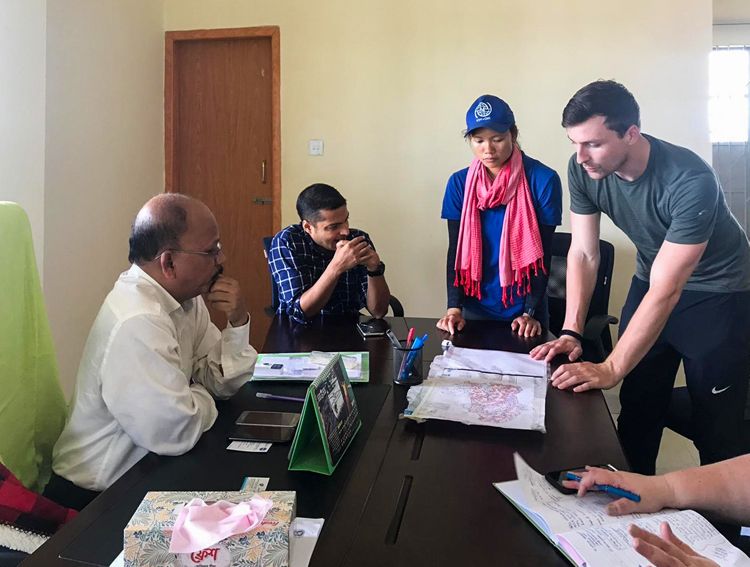
Credit: United Nations Development Programme/Eno Jonathan
Tell us about a unique or interesting component of your work-life balance.
I juggle a lot of different aspects of my work, which is something I greatly appreciate since it allows me to learn from people with a vast array of experiences, from NASA scientists producing raw observations to disaster responders in the National Guard putting the data into action. A big part of supporting disaster response activities is that you can’t schedule it – our team often jokes that Friday at 4:55pm is when disasters are most likely to strike. Every day, I check a number of different resources to check what hazards have occurred or are likely to occur around the world, to try and gauge what level of effort might be required to support the various agencies involved. I’ve also spent a fair few hours in the middle of the night on calls with stakeholders beyond the US to try and understand their needs better. This is work definitely driven by passion but our team is quick to support each other and ensure we’re able to maintain a good work-life balance.
What is one thing you wish the public understood about your field of work?
Much of my work sits squarely in ‘Applied’ science, and I work closely with stakeholders from across the public and private sector. I think one of the most challenging concepts to communicate is uncertainty – scientists have an urge to attach a degree of uncertainty to their findings and to ensure that their results are couched in the appropriate level of context, but often decisions being made by stakeholders are quite binary – so uncertainty can sometimes get forgotten if it’s a yes-no decision. I have sometimes found that there is a sweet spot where we as researchers know enough about the decisions being made, and the humans making those decisions, that we can explain uncertainty in a way that helps, rather than hinders, decision making. But it takes a lot of engagement with decision makers to get to that point! So, while I’d love for the public to understand more about what uncertainty means for scientists, I think it’s just as important for scientists to understand how their results are seen by the public.
Credit: Robert Emberson
What keeps you inspired by your work?
My personal perspective is that the 21st century is the century where applied science will be more important than pure research. The number of challenges we face, from climate change to food security, means that we need science for solutions in almost every aspect of our daily lives. I am proud to take part in that effort as part of NASA’s Earth Sciences division, and I am continually impressed and inspired by my colleagues innovating incredible solutions to help people all over the world live better lives. I think that the traditional idea of science in dusty ‘ivory towers’ is totally blown away by the work that NASA does, not only in solving problems but also in connecting with the public. I love seeing students and adults picking up new ideas and supporting a shared objective through citizen science initiatives.
Biography
Home Town:
Harpenden, United Kingdom
Undergraduate Degree:
Master of Science in Earth Sciences, University of Cambridge, UK
Post-graduate Degrees:
Doctorate in Geomorphology / Geo-ecology, University of Potsdam, Germany

Link to Dr. Emberson's GSFC Bio