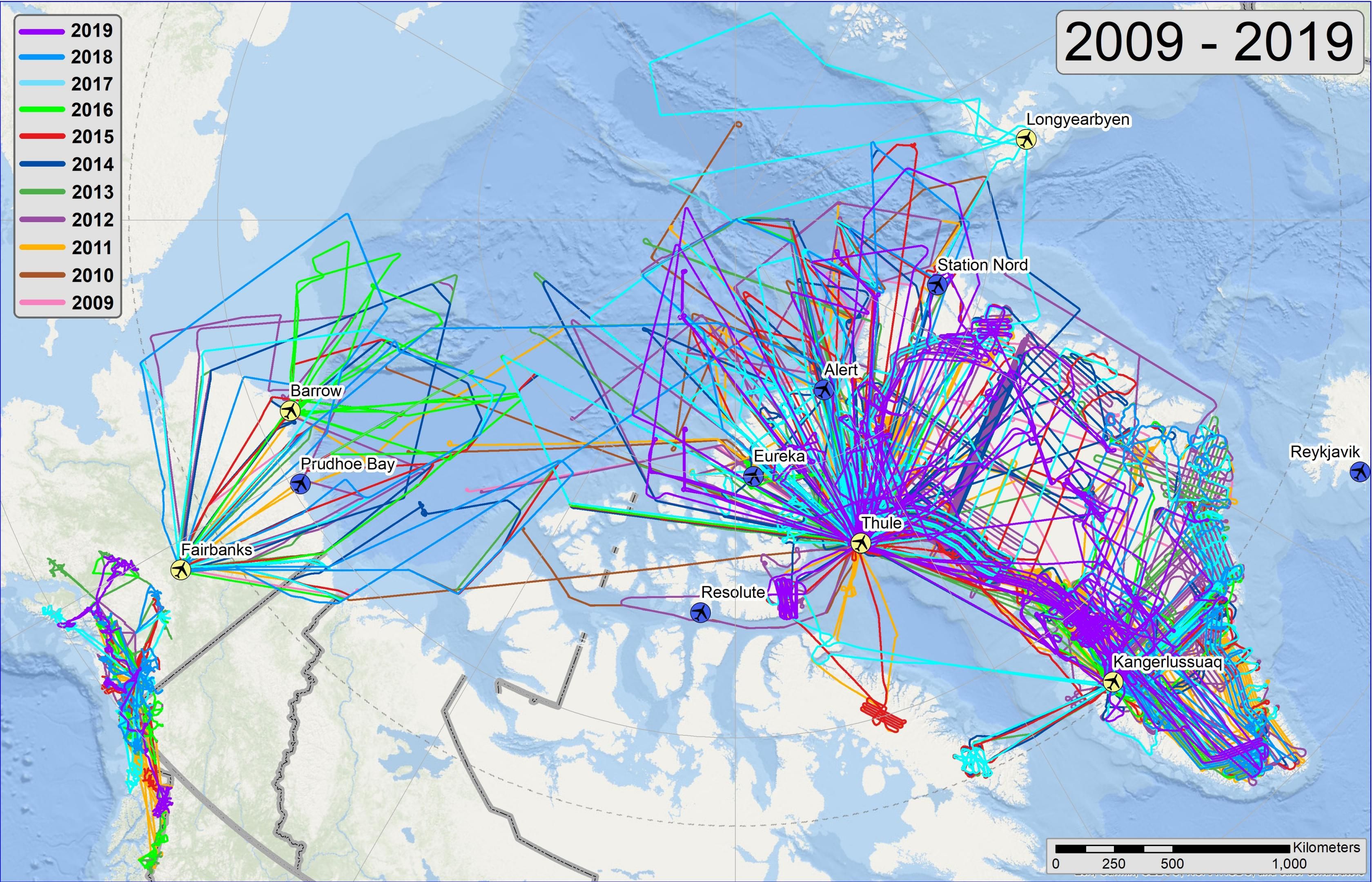
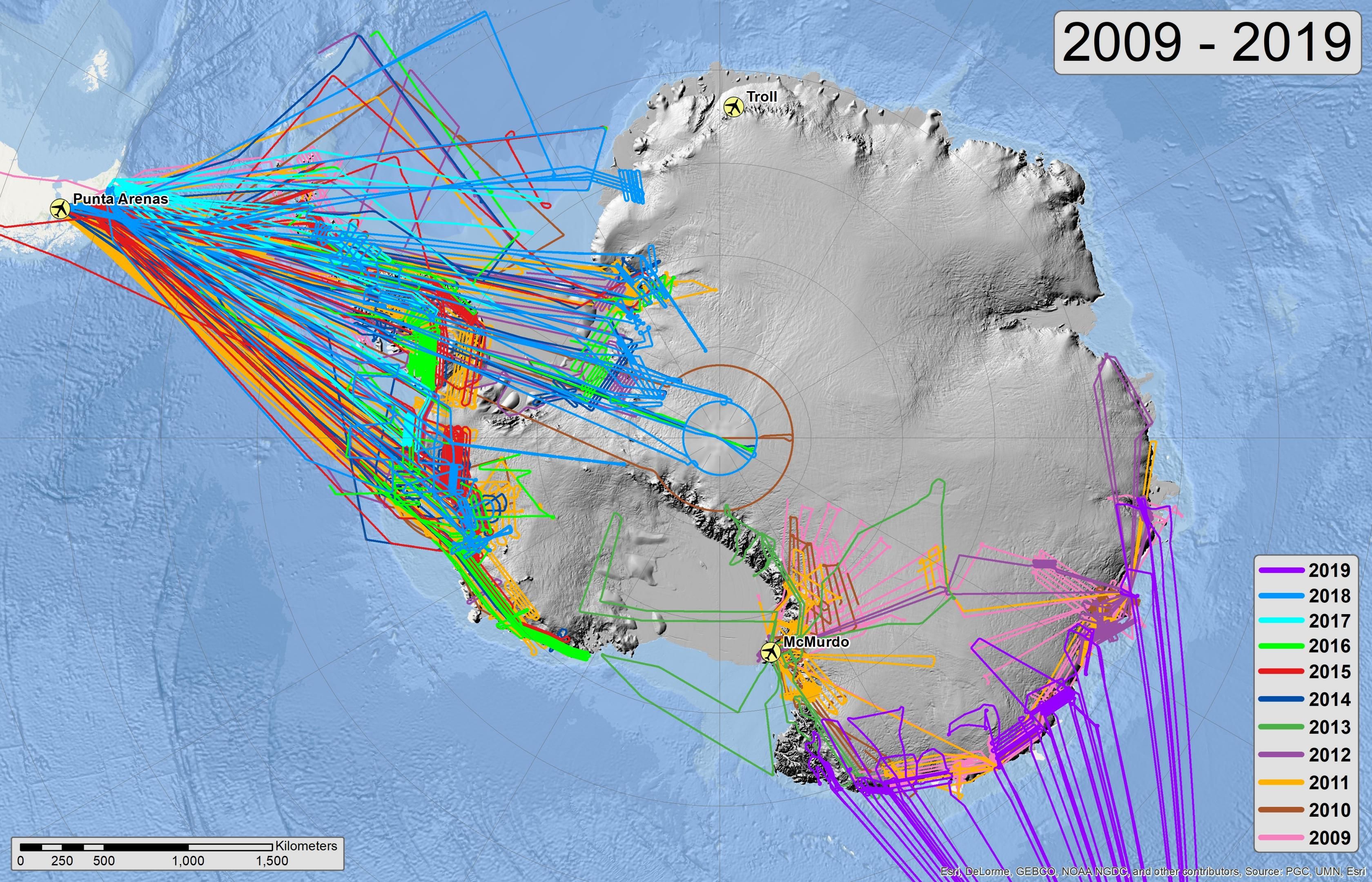
NASA’s Operation IceBridge imaged Earth’s polar ice in unprecedented detail to better understand processes that connect the polar regions with the global climate system. IceBridge utilized a highly specialized fleet of research aircraft and the most sophisticated suite of innovative science instruments ever assembled to characterize annual changes in thickness of sea ice, glaciers, and ice sheets. In addition, IceBridge collected critical data used to predict the response of earth’s polar ice to climate change and resulting sea-level rise. IceBridge also helped bridge the gap in polar observations between NASA’s ICESat satellite missions. IceBridge officially ended in 2021.
NASA’s Operation IceBridge imaged Earth’s polar ice in unprecedented detail to better understand processes that connect the polar regions with the global climate system. IceBridge utilized a highly specialized fleet of research aircraft and the most sophisticated suite of innovative science instruments ever assembled to characterize annual changes in thickness of sea ice, glaciers, and ice sheets. In addition, IceBridge collected critical data used to predict the response of earth’s polar ice to climate change and resulting sea-level rise. IceBridge also helped bridge the gap in polar observations between NASA’s ICESat satellite missions. IceBridge officially ended in 2021.
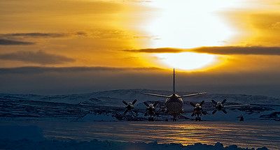
The NASA P-3 on the ramp in Thule, Greenland, in 2013.
Credit: Michael Studinger
The NASA DC-8 on the ramp in Punta Arenas, Chile, in 2012.
Credit: Jeremy Harbeck
Completed IceBridge Flights
Related Publications
2026.
"A Vast Valley Network Beneath the Greenland Ice Sheet.",
Geophysical Research Letters,
53
(13):
e2026GL122028
[10.1029/2026gl122028]
[Journal Article/Letter]
2026.
"Ice sheet attenuation from radar sounding in the frequency domain.",
Journal of Glaciology,
72
e17
[10.1017/jog.2026.10130]
[Journal Article/Letter]
2026.
"Exploring the conditions conducive to convection within the Greenland Ice Sheet.",
The Cryosphere,
20
(2):
1071-1086
[10.5194/tc-20-1071-2026]
[Journal Article/Letter]
2025.
"Review article: AntArchitecture – building an age–depth model from Antarctica's radiostratigraphy to explore ice-sheet evolution.",
The Cryosphere,
19
(10):
4611-4655
[10.5194/tc-19-4611-2025]
[Journal Article/Letter]
2025.
"Towards an improved understanding of the Antarctic coastal zone and its contribution to future global sea level.",
ESS Open Archive,
[10.22541/essoar.175241971.19851046/v1]
[Journal Article/Letter]