Early Career Scientist Spotlight
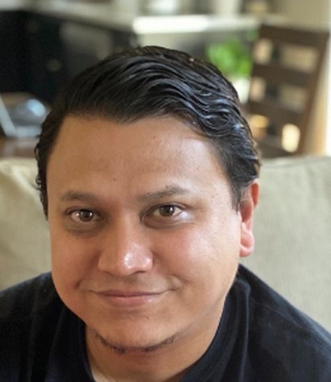
Dr. Pukar Amatya (he/him/his)
Remote Sensing Scientist
Hydrological Sciences Laboratory (617)
What is your research focus?
I love working with satellite imagery. My main research focus is to develop algorithms capable of rapidly mapping landslides using Synthetic Aperture Radar (SAR) and optical imagery. I develop open-source systems that use machine learning and very high-resolution imagery to map landslides, eliminating the need for manual mapping which is very time consuming and subjective.
How did you end up working at NASA Goddard?
Two weeks before my PhD defense in April 2015, a 7.8 magnitude earthquake struck Nepal. It was a very difficult time for me personally to see destruction and death in the news while preparing for my defense. One of the pressing issues that kept on coming up in science-related articles was landslides, and particularly how landslides dammed the rivers. During this time, I made up my mind to work in the natural hazards field using the knowledge I had gained on image processing. My search led me to a posting on the American Geophysical Union (AGU) career center about an opportunity to work at Goddard with a primary focus on developing landslide mapping systems using SAR and optical sensors. I got selected for the interview and was pleasantly surprised to find that the project was studying landslides along transportation corridors in Nepal. Without a doubt, I decided to jump at the opportunity.
Credit: Pukar Amatya
Tell us about the research project(s) you are currently working on.
I am currently working with the landslides team in the Hydrological Sciences Laboratory. We map and model landslide hazards at different scales. For our High Mountain Asia and Disasters projects, my primary role within the team is to develop automated open-source landslide mapping algorithms to generate landslide inventories using optical and SAR imagery. I also work with commercial imagery to investigate their suitability to enhance and enable NASA’s Earth Science Division research efforts. I am also involved in the Committee on Earth Observation Satellites (CEOS) Landslide Demonstrator to highlight the use of commercial and space agency data for landslide applications. Finally, a good chunk of my time is spent on the SERVIR Applied Science Team. The goal of SERVIR is to improve environmental management and resilience by strengthening the capacity of users to integrate Earth observation information and geospatial technologies into development decision-making. We are improving the capacity of regional and governmental organizations in the Lower Mekong Region to build resiliency to landslides using earth observation-based models which predict landslides in near real-time or with days lead time (forecast).
Credit: Pukar Amatya
What research accomplishment are you most proud of?
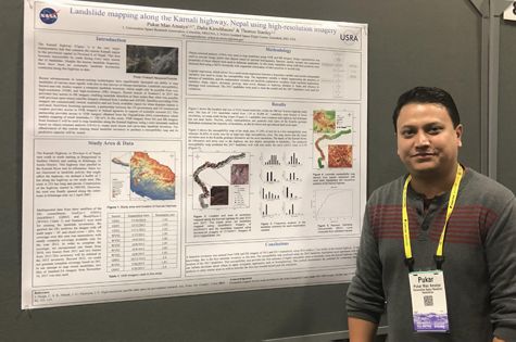
Fortunately, during my career, I have had mentors who let me chart my own research path under their guidance. One research accomplishment I am very proud of is the development of the open-source Semi-Automatic Landslide Detection (SALaD) system. SALaD uses optical imagery and machine learning to rapidly map landslides. SALaD has enabled us to support various disaster events by providing landslide location information to first responders and compiling landslide inventories which enables training and validation of landslide models. Another accomplishment is the development of the Google Earth Engine-based landslide detection system using SAR imagery which is a collaborative effort led by the University of Maryland (UMD) and the Jet Propulsion Laboratory (JPL). Being open source, these systems are available online and can be used by anybody interested in landslide mapping and detection.
What is an interesting problem or hurdle that you’ve overcome in your work?
Being completely new to the landslide field at Goddard, there was a learning phase during which I was fortunate enough to get guidance from my experienced colleagues. Entering the field of machine learning and having to learn a new programming language to support the open research goals of NASA both brought their own sets of challenges. A period of self-learning using a plethora of online resources and support from my colleagues was vital for me to be able to design a new landslide mapping system from scratch.
Credit: Pukar Amatya
If you were to expand your current research focus, what new topic(s) would you explore?
Deep learning for landslides is a field I am very much interested in. Model development is one part, but I think the most important and challenging part lies in generating and compiling training data. There is a lack of diverse, open, and robust training datasets. I would like to work towards multi-sensor harmonization and generation of training data. Commercial SAR platforms with on-demand tasking capabilities would enable us to respond to disasters in near real-time as they can penetrate clouds and offer nighttime visibility. Testing the suitability and feasibility of these platforms will also be a research focus of mine.
Credit: Pukar Amatya
What do you like to do in your free time?
I love to travel and gaining new experiences. However, as a new parent during the pandemic times, I have really started to enjoy quick camping trips with my family. I cannot wait to resume travel and share great experiences with my family again.
Biography
Home Town:
Lalitpur, Nepal
Undergraduate Degree:
Bachelor’s degree in Civil Engineering, Tribhuvan University, Nepal
Post-graduate Degrees:
M. Sc., Water Resources and Environmental Management, University of Twente, The Netherlands
PhD, Atmospheric Physics and Atmospheric Environment, Chinese Academy of Sciences, China