Early Career Scientist Spotlight
Dr. Denis Felikson
Cryospheric Scientist
Cryospheric Sciences Laboratory
What is your research focus?
I study how the Earth’s ice sheets are changing and what drives the change. By understanding how the ice sheets have changed in the past, I use models to improve projections of future sea-level rise. To measure how the ice sheets are changing, I use data collected by satellites and aircraft. NASA has been measuring ice sheet surface elevation change using a technique called laser altimetry since 1993 with instruments like the Airborne Topographic Mapper (ATM), the Geosciences Laser Altimeter (GLAS), and the Advanced Topographic Laser Altimeter System (ATLAS). A laser altimeter transmits light pulses and measures the time it takes for the light to travel to the surface of the ice sheet and back. By knowing the position of the laser precisely, we can measure the height of the ice sheet surface. And by surveying the same points on the ice sheet surface year after year, we can measure how the ice thickness is changing over time. We now have a long laser altimetry record, up to 30 years in some places, of the changing surface of the ice sheet and can very precisely measure how much ice has been lost and where on the ice sheet that ice is coming from. When we combine this with measurements of the atmosphere and the oceans, we can explore what caused the changes that we’re measuring.
Ultimately, we want to be able to make accurate projections of how Earth’s sea level will change over the next 100 years. To do this, I use numerical models that simulate the flow of the ice sheet and how that flow changes in response to changes in the atmosphere and oceans. I use NASA’s laser altimetry data, along with other types of measurements, to calibrate models and then use the calibrated models to make projections for how the ice sheets will change over the next century. This provides an estimate of one contribution to sea-level change: the loss of ice from the ice sheets. When combined with other contributions (thermal expansion of the oceans and melting mountain glaciers), we can get a measure of total global sea level rise.
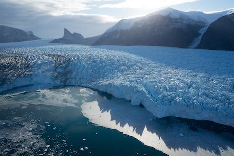
Credit: Denis Felikson
What motivated you to pursue a career in Cryospheric Science?
I was always interested in Earth Science, ever since I was a kid. But I was also interested in satellites, rockets, and space flight. So, when I went to college, I picked Aerospace Engineering as my major. After graduating and working as an engineer, I still had the Earth Science itch and I went back to graduate school, where I happened to take a class in glaciology – the study of glaciers and ice. That class showed me that there were still some fundamental, important questions about ice sheets that were unanswered and that these unknowns were preventing us from making accurate projections of sea-level rise over the next 100 years. The class left a big impression on me and got me excited to try to answer some of these science questions. And I realized that I could use satellite data to do it!
What do you enjoy the most about your job?
I love having the freedom to craft my own research projects. Writing a science research proposal is like putting together a puzzle: you choose what science questions you want to answer, what tools you will use, and who will be on your team. The first step is to brainstorm the science questions that the project will address. This is my favorite part because this is when I think about the big picture of what past research has answered and what needs to be done to improve our understanding and to move research forward. The next step is to decide what measurements and models are needed to answer your research questions. This is when it starts to get challenging because you have to either prove that you have the tools to get the job done or you have to design new tools that you’ll need. Finally, you have to write a proposal that convinces your peers that your project will be successful. It’s a big challenge to convince skeptical scientists that your team will be able to answer important science questions, but it makes winning proposals that much sweeter!
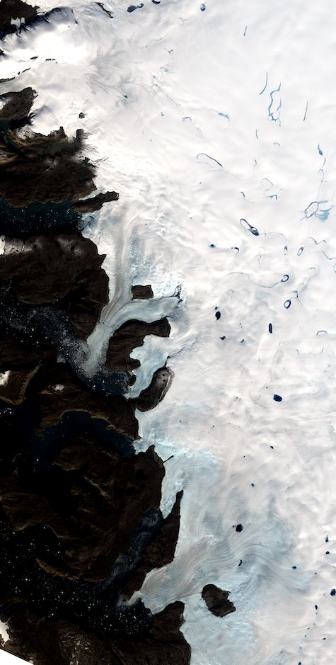
Credit: Landsat 8 imagery courtesy of the U.S. Geological Survey
What is one space mission that you are particularly excited about, and why?
NASA’s Ice, Cloud and land Elevation Satellite-2 (ICESat-2), launched in October 2018, is providing our first ice-sheet-wide laser altimetry measurements of seasonal thickness change and this is going to improve our understanding of how the ice sheet behaves on short time scales. These measurements are going to help researchers like me create better models and more accurate projections of sea-level rise over the next century. I work with the ICESat-2 Project Science Office to help oversee the production and delivery of some of the scientific data products produced by ICESat-2.
What is one research project that you are particularly excited about, and why?
I’m lucky enough to be a member of NASA’s Sea-Level Change Team (N-SLCT), a large multidisciplinary team of researchers across NASA and academia who are working collaboratively to improve our understanding of past and future sea-level change. This project is particularly exciting because it’s bringing so many researchers together to work on a common problem. By coordinating our individual research tasks and presenting results to the whole team, we all learn from one another and develop a common understanding for how to improve on past research. This is helping to advance the science of sea-level change more rapidly than it would without having this interconnected team and I’m excited to be a part of it!
What early career advice do you have for those looking to do what you do?
First, and most importantly, seek strong mentors. I’ve been lucky to have two incredible mentors in Dr. Ginny Catania during my Ph.D. and Dr. Sophie Nowicki during my postdoc. They gave me invaluable advice on my research, my career, and life in general! Remember that your direct supervisor doesn’t necessarily need to be your mentor. Connect with others around you, ask them questions about their work and their career path, and see who you best get along with.
Second, learn scientific computing. These days, there is so much Earth science data out there and to be a successful researcher, you’ll likely have to use multiple sources of data and models to answer innovative research questions. Learning strong programming and computing skills will let you work efficiently and will make it easier to incorporate new data sets into your work.
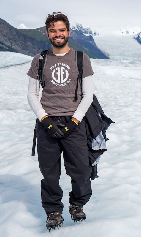
Credit: Laura Kissinger
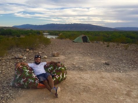
What do you like to do outside of work?
I love to spend time outside, taking trips to go camping and hiking. Even though I’m a Cryospheric Scientist, I learned to love the heat on camping trips in Texas, as long as there’s a swimming hole around! When not on a camping trip, I play tennis and downhill ski.
Biography
Home Town:
Rockville, MD
Undergraduate Degree:
Aerospace Engineering, University of Maryland, College Park, MD
Post-graduate Degrees:
M.S. & Ph.D. Aerospace Engineering, University of Texas at Austin, Austin, TX
Link to Dr. Felikson's GSFC Bio