Research Areas
Jump:
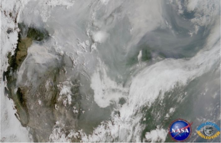
Aerosol Remote Sensing and Modeling
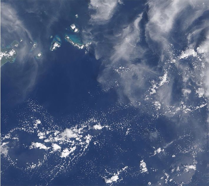
Cloud Remote Sensing and Modeling
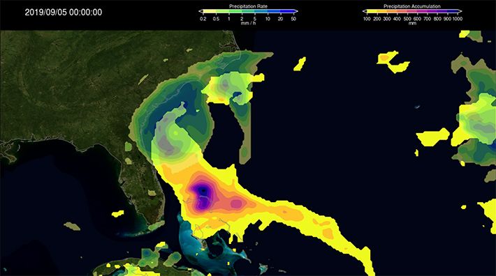
Water Cycle and Precipitation
Sun and Climate
Surface Properties
Climate Analysis
Radiative Transfer
Aerosol Remote Sensing and Modeling
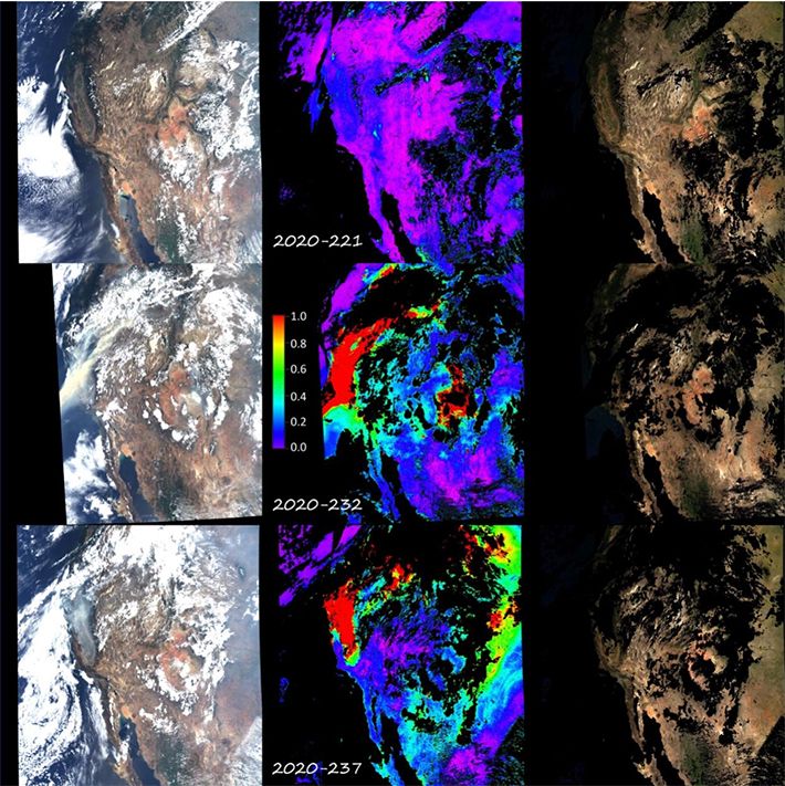
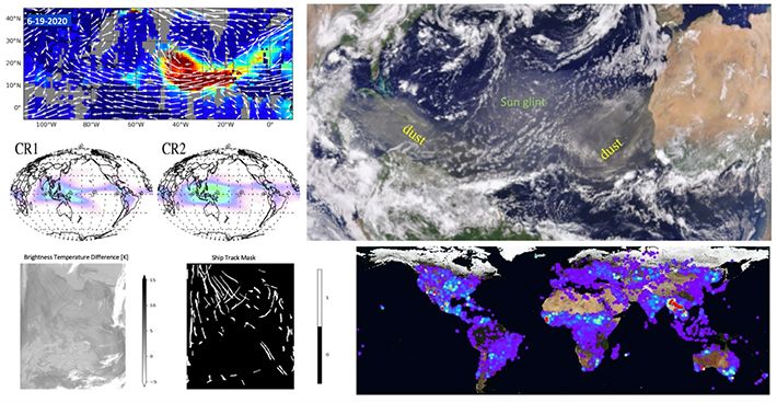
The Climate and Radiation Laboratory (CRL) has a very active group studying the climate, air quality, and other impacts of airborne particles (“aerosols”). Aerosol particles reflect sunlight, which tends to cool surfaces locally. Some also absorb sunlight, warming and stabilizing the ambient atmosphere while still cooling the surface below, sometimes suppressing cloud formation, and even affecting large-scale atmospheric circulation. In addition, aerosols are critical participants in the formation of cloud droplets and ice crystals, functioning as the collectors of water vapor molecules during the initial stages of cloud development. Particle abundance and properties affect the brightness, thickness, and possibly lifetimes of clouds and ultimately, precipitation and the terrestrial water cycle. And in significant near-surface concentrations they are pollutants, reducing visibility and raising both short- and long-term health risks for those exposed.
Cloud Remote Sensing and Modeling
Clouds play a critical role in the Earth's hydrological cycle and in the energy balance of the climate system. They strongly influence solar heating by reflecting part of the incident solar radiation back to space. Clouds also reduce the planet’s ability to cool by intercepting part of the thermal infrared radiation emitted by the surface and atmosphere below, and re-emitting a fraction of this radiation back towards the surface. Global changes in surface temperature are highly sensitive to cloud amount and type, a major reason for the largest uncertainty in model estimates of global warming being due to clouds.
Water Cycle and Precipitation
Earth is the only inner planet where all three phases of water (liquid, ice, and vapor) coexist, and 70% of its surface is covered by oceans. The various transport mechanisms of water and its perpetual phase changes are essential elements of the planetary water cycle (also known as the hydrological cycle). Precipitation is a major component of the planet’s water cycle, and is the source of most of its fresh water. It occurs when water vapor levels in the atmosphere reach saturation upon which water vapor condenses or deposits on small particles called condensation/ice nuclei to form clouds consisting of suspended liquid or ice particles or a mixture of both. Under appropriate conditions larger liquid and ice particles form inside the clouds, fall through the atmosphere because of gravity, and often survive evaporation to reach the surface as precipitation. Precipitation is associated with a vast range of weather events: tropical cyclones, thunderstorms, frontal systems, drizzle, snowfall, etc.
Sun and Climate
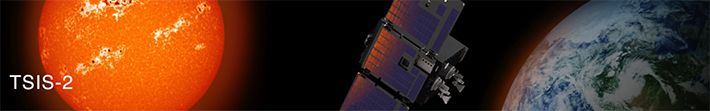
The Sun is a variable star, and Earth is a sun-powered planet. The Climate and Radiation Lab (CRL) plays a critical role in developing and operating NASA’s solar radiation missions, which provide fundamental solar irradiance measurements for Sun-Climate research. Satellite observations have revolutionized our view of the Sun, providing the most accurate measurements to study both active and quiet Sun. A challenging question that remains is whether the quiet Sun is a time-invariant base level or a secular change in the Sun’s radiative output exists. Continuing the legacy of the NASA’s Solar Radiation and Climate Experiment (SORCE), the Total and Spectral Solar Irradiance Sensor -1 (TSIS-1) carries the state-of-the-art instruments enabling the most accurate total and spectral solar irradiance measurements and has been taking solar observations from the International Space Station (ISS) since 2018. NASA is planning to launch TSIS-2 in 2025 on a free flyer to continue these solar irradiance measurements.
Surface Properties
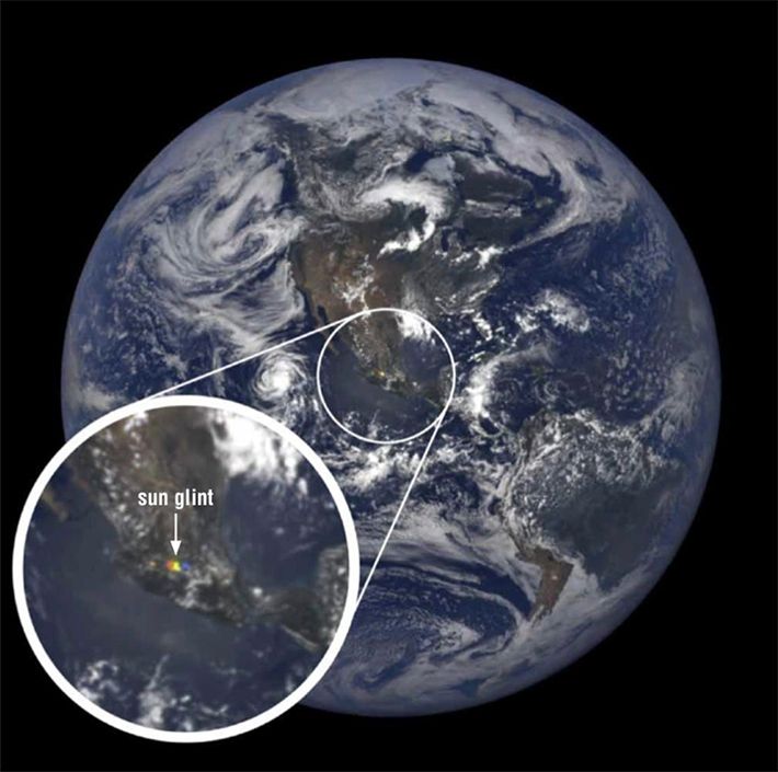
The reflectance of natural surfaces depends on viewing geometry, i.e., the position of the observer or measuring instrument relative to the Sun. Land surfaces usually appear darker in the forward scattering direction (i.e, with the Sun in front of the observer) and significantly brighter in the backscattering direction (i.e., with the Sun behind the observer). This dependence arises largely from the 3-D structure and roughness of the surface due to the interplay between shadowed and sunlit facets. For example, shadows are absent in the backscattering direction, which creates a reflectance “hot spot,” whereas they maximize in the forward scattering direction where they darken the surface. Solar photons may also be trapped bouncing between surface elements such as tree leaves before escaping. The number of such "internal" scattering events is modulated by the general brightness of the surface, creating additional angular dependence. Snow, the brightest type of surface at visible wavelengths, has maxima at both forward and backscattering angles, whereas water reflects light primarily in the forward scattering, or “glint,” direction. Wind forms waves and roughens water surfaces; stronger winds induce steeper waves, widening the glint "cone" and reducing its peak brightness.
Climate Analysis
The goal of climate analysis is to better understand the Earth’s past and present climates, and to predict climate response to changes in natural and human-induced factors, such as the Sun, greenhouse gases (e.g., water vapor, carbon dioxide and methane), and aerosols (e.g., from dust storms, pollution, fires, sea spray or volcanic eruptions). Climate analysis studies are routinely carried out by combining data from diverse sources including historical climate records, current and past satellite instruments, field campaigns, and outputs from regional and global numerical models.
Radiative Transfer
The Sun is a distant source of energy that reaches the Earth as spectrally rich solar radiation. The solar radiation relevant to Earth’s climate consists of ultra-violet radiation largely absorbed by stratospheric ozone, visible radiation to which the atmosphere is mostly transparent, and near-infrared and solar infrared radiation where some absorption by atmospheric water vapor occurs. In addition to solar radiation, the spectral region of longer-wavelength thermal-infrared radiation coming from terrestrial sources (the Earth’s surface and atmosphere) is equally important for weather and climate. Scientists in the Climate and Radiation Lab (CRL) study the individual spectral regions of solar and thermal radiation as well as the propagation of total (also known as “broadband”) shortwave and longwave fluxes to better understand the Earth’s radiation budget. The total solar flux across all wavelengths reaching the Earth is ≈ 1361 Wm-2, a number that has an important implication for the energy balance in Earth’s climate. Its slight variations are monitored as continuously and accurately as possible from space by missions such as the past SOlar Radiation and Climate Experiment (SORCE), and the recent Total and Spectral Solar Irradiance Sensor (TSIS) in which CRL has an overall responsibility for project science management.