Research Areas
Aerosols & Clouds
Clouds play an important role in weather and climate on local to global scales. Clouds reflect sunlight and trap heat, affecting the Earth’s heat budget. The release of latent heat energy through the formation of clouds and precipitation is an important heat source for the atmosphere, affecting the large-scale circulations of the atmosphere.
Precipitation and Fluxes
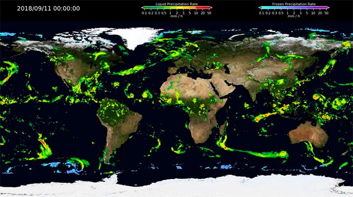
Advances in our understanding of global hydrological processes will require detailed precipitation estimates on a broad range of time and space scales. Satellite observations provide a critical contribution toward mapping global rainfall and its variability. Over long time periods, monthly records of precipitation will prove valuable in determining global and regional precipitation trends and possibly separating anthropogenic changes from the large natural variations in rainfall. On shorter time and space scales, global maps of rainfall and latent heating structure will prove very useful as validation tools for general circulation models as they attempt to forecast climate conditions. Assimilation of the precipitation information into global and regional models should produce more realistic simulations. On even smaller time and space scales, knowledge of surface rainfall will be useful for the improvement of surface hydrology models.
Atmospheric Profiling
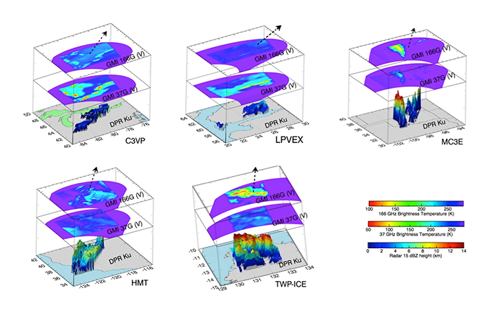
The circulation of the atmosphere is affected by the horizontal, vertical, and temporal distribution of atmospheric constituents such as water vapor, aerosols, clouds, precipitation, and latent heat released by cloud formation. Improving our ability to predict weather and climate depends upon accurate representation of these constituents in the vertical dimension. However, the depth and turbulence of the atmosphere make observing gases and microscopic particles in the vertical dimension, i.e., profiling, particularly challenging. Scientists conceive, design, develop, and implement ultraviolet, infrared, optical, radar, laser, and lidar technology for profiling the atmosphere. These instruments are deployed both in field experiments and in regular operations for weather forecasting. They use the observations from these instruments to construct profiles of winds, water vapor, aerosols, and precipitation for applications that include satellite sensor calibration and Earth system model development and validation.
Modeling and Dynamics
Mesoscale dynamics and modeling research seeks to understand the physics and dynamics of atmospheric processes through the use of computer-based simulations and various observations, including satellite remote sensing, aircraft, and surface-based in-situ observations. Development of advanced computer-based storm simulations and regional/global weather/climate simulations is a primary focus.