Missions & Projects
For further information, data, research, and other resources, see Geodesy and Geophysics Projects.
Featured
Alphabetical
By Last Name:
Displaying records 1 to 19 of 19.
Show:
Apache Point Observatory
The Apache Point Lunar Laser Ranging Station utilizes the Astrophysical Research Consortium 3.5-meter telescope at the Apache Point Observatory in Sunspot, New Mexico. The large collecting area of the Apache Point 3.5 m diameter telescope, good atmospheric conditions at the site, and the efficient avalanche photodiode arrays used by the station result in a high-detection rate (even multiple detections per laser pulse) leading to millimeter-level range precision.
Key Staff
- Research Associate: Nicholas Colmenares
- Research Associate: Vishnu Viswanathan
- Project Manager:
- Instrument Scientist: Evan Hoffman
Crustal Dynamics Data Information System (CDDIS)
The Crustal Dynamics Data Information System (CDDIS) is NASA’s public, active archive of space geodesy data, derived products, and related information. The CDDIS is funded by NASA but cooperates extensively with the international community in support of Earth science research. The CDDIS supports a large international community of geodesy, solid Earth, and natural hazards researchers by providing timely access to the contents of its archive. The archive includes Global Navigation Satellite System (GNSS), Satellite Laser Ranging (SLR), Very Long Baseline Interferometry (VLBI), and Doppler Orbitography and Radiopositioning Integrated by Satellite (DORIS) data as well as products derived from these data. The CDDIS is one of NASA’s Earth Observing System Data and Information System (EOSDIS) Distributed Active Archive Centers (DAACs). All data, products, and information are online and openly available through anonymous ftp and web access.
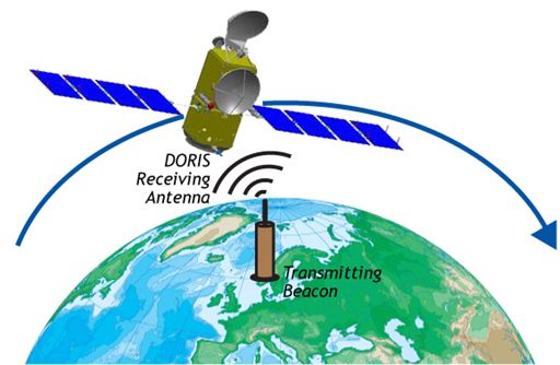
Doppler Orbitography by Radiopositioning Integrated on Satellite (DORIS)
The Doppler Orbitography by Radiopositioning Integrated on Satellite (DORIS) was developed in France by the Centre National d'Etudes Spatiales (CNES) with the cooperation of Groupe de Recherche en Géodésie Spatiale (GRGS) and the Institut Géographique National (IGN).
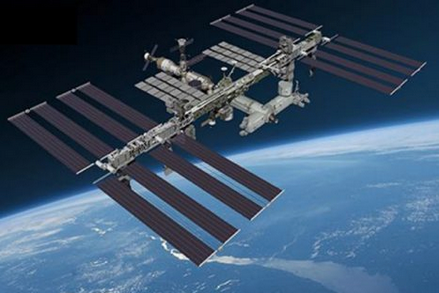
Global Ecosystem Dynamics Investigation (GEDI)
The Global Ecosystem Dynamics Investigation (GEDI) is a laser-based instrument for mapping the 3-D structure of Earth’s forests. Led by the University of Maryland, College Park, and built by Goddard, GEDI was deployed on the International Space Station in 2019, and has provided the first comprehensive, high-resolution measurements of the vertical canopy structure of Earth’s temperate and tropical forests.
Key Staff
- Principal Investigator: RALPH DUBAYAH
- Deputy Principal Investigator: J Blair
- Deputy Principal Investigator:
- Co Investigator:
- Co Investigator: Lola Fatoyinbo Agueh
- Co Investigator: Michelle Hofton
- Co Investigator:
- Co Investigator: Scott Luthcke
- Co Investigator:
- Co Investigator:
- Instrument Scientist: J Blair
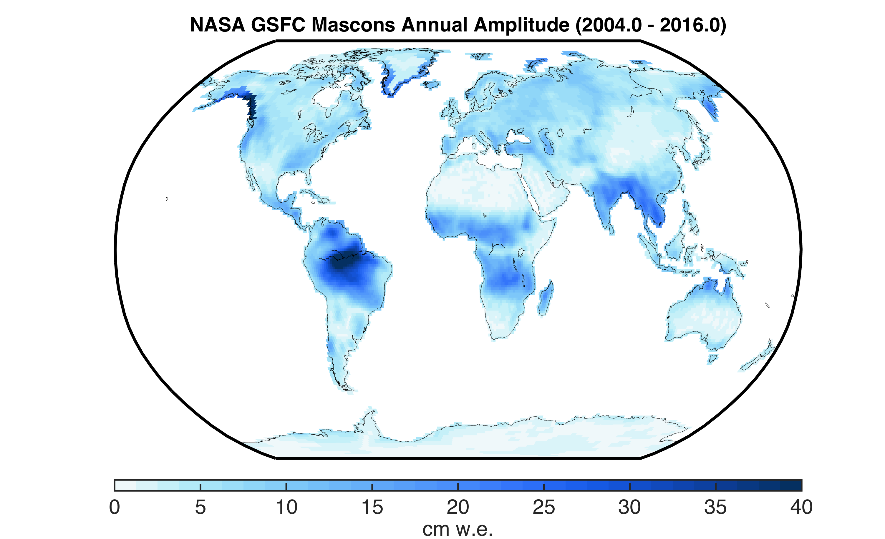
GRACE Time-Variable Gravity Mascons
The GRACE gravity group at GSFC pioneered the estimation of global mass concentration blocks (mascons) from the GRACE Level-1B satellite-to-satellite K-band range-rate (KBRR) measurements. These unique solutions apply prior knowledge of the geophysical signals via constraints towards improved solutions and the reduction of signal leakage across constraint region boundaries. The monthly mascon solutions now span more than a decade, and provide critical information of global water mass variability for hydrologic, cryospheric, and oceanographic research.
Gravity Recovery and Climate Experiment Follow-On (GRACE-FO)
GRACE-FO continues the work of the GRACE mission, tracking mass change on the Earth, in the cryosphere, the oceans, with terrestrial water storage on land and in the solid Earth.
Key Staff
- Co Investigator: Richard Ray
- Co Investigator: Bryant Loomis
- Co Investigator: Jeanne Sauber
- Co Investigator: Scott Luthcke
ICESat 2: Ice, Cloud, and Land Elevation Satellite 2 (ICESat-2)
The Ice, Cloud, and Land Elevation Satellite-2, or ICESat-2, measures the height of a changing Earth, one laser pulse at a time, 10,000 laser pulses a second. Launched September 15, 2018, ICESat-2 carries a photon-counting laser altimeter that allows scientists to measure the elevation of ice sheets, glaciers, sea ice and more - all in unprecedented detail.
Key Staff
- Support Scientist: Stephen Holland
- Receiver Algorithms Lead: Jan Mcgarry
- Senior Support Scientist: Scott Luthcke
- Calibration Team Member: Philip Dabney
- Sr. Test Systems Engineer: Henock Legesse
- Project Scientist: Thomas Neumann
- Deputy Project Scientist: Nathan Kurtz
- Instrument Scientist: Anthony Martino
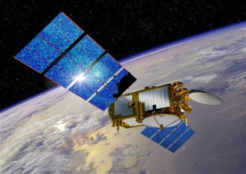
Jason-3
The Jason-3 ocean radar altimeter mission continues the mapping of the ocean surface topography from the 9,91 day repeat orbit first used and established by TOPEX/Poseidon in 1992.
Key Staff
- Co Investigator: Richard Ray
- Co Investigator: Frank Lemoine
- Co Investigator: Charon Birkett
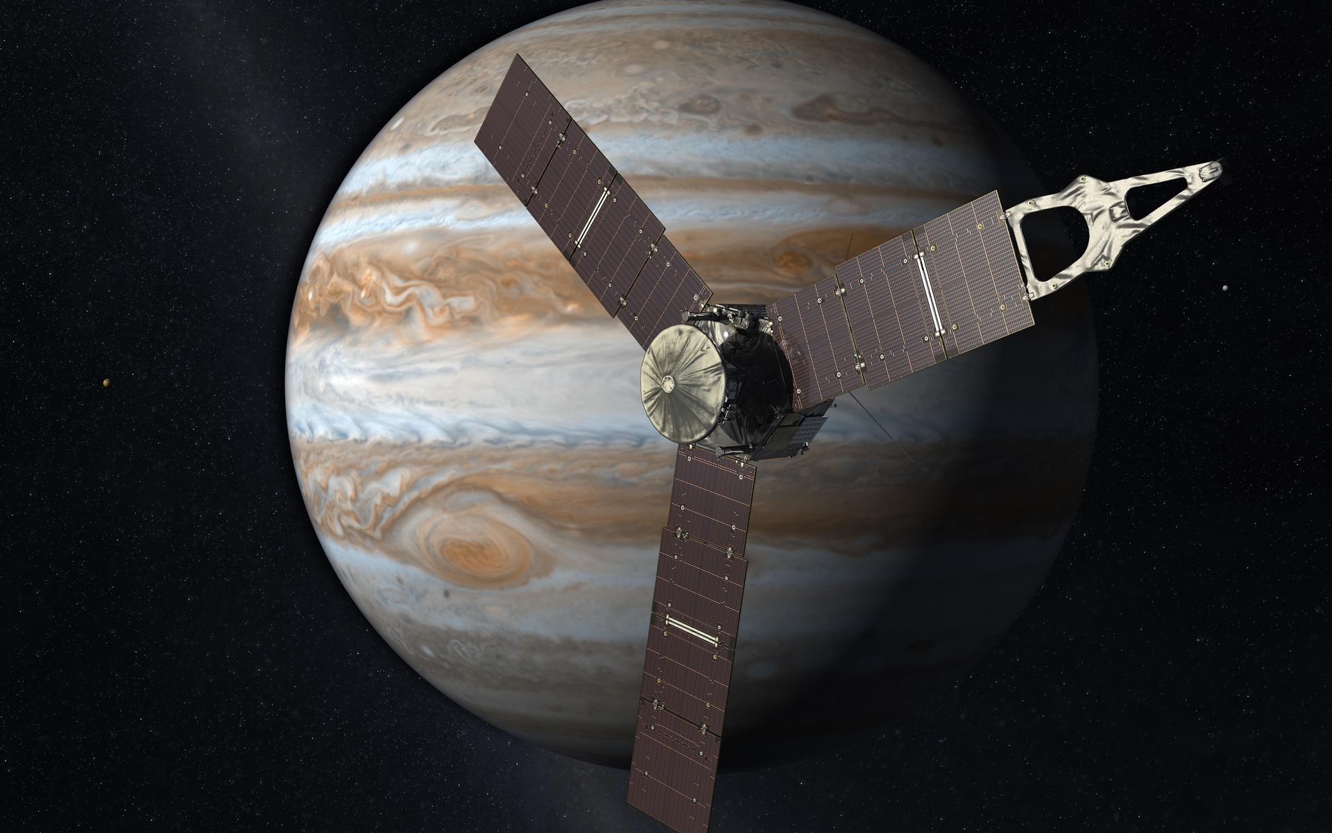
Juno
The Juno spacecraft successfully entered the orbit of Jupiter on July 4, 2016. Its suite of instruments allow it, for the first time, to peer below the dense cover of clouds to answer questions about the gas giant and the origins of our solar system. Juno's primary goal is to reveal the story of Jupiter's formation and evolution. Using long-proven technologies on a spinning spacecraft placed in an elliptical polar orbit, Juno observes Jupiter's gravity and magnetic fields, atmospheric dynamics and composition, and evolution.
Key Staff
- Participating Scientist: Sander Goossens
- Co Investigator: Katherine Garcia-Sage
- Co Investigator: John Connerney
- Co Investigator: Gordon Bjoraker
- Co Investigator: Weijia Kuang
Instruments
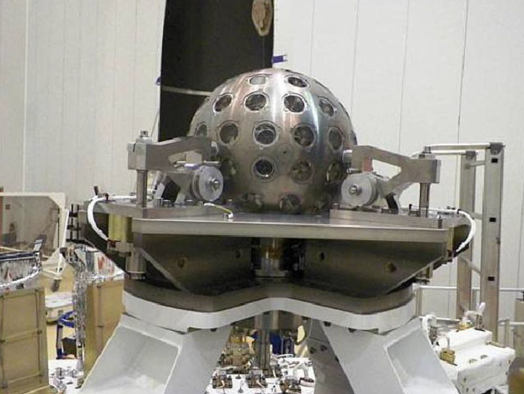
LAser RElativity Satellite-2 (LARES-2)
LARES-2 is a satellite designed for Satellite Laser Ranging (SLR) and is a follow-on mission to the LARES satellite launched in 2012.
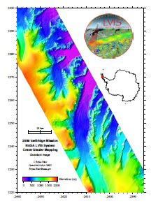
Laser, Vegetation and Ice Sensor (LVIS)
NASA's Laser Vegetation Imaging Sensor( Land, Vegetation, and Ice Sensor) or LVIS, is a scanning laser altimeter instrument that is flown, by aircraft, over target areas to collect data on surface topography and vegetation coverage. The LVIS, which also includes data from an integrated inertial navigation system (INS) and global positioning system (GPS), is designed, developed and operated by the Laser Remote Sensing Laboratory, at Goddard Space Flight Center.
Key Staff
- Principal Investigator: J Blair
- Co Investigator: David Rabine
- Co Investigator: Michelle Hofton
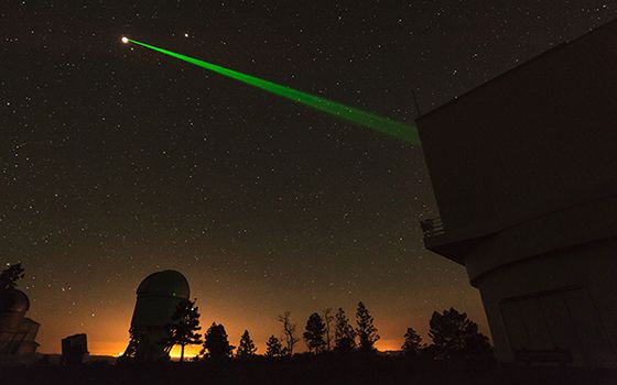
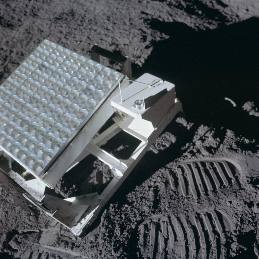
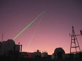
Lunar Laser Ranging (LLR)
Starting in July 1969, the Apollo and Lunaxhod programs deployed a variety of scientific experiments on the surface of the Moon. Among those devices were laser ranging retroreflectors, which, a generation later, still yield fundamental scientific data.
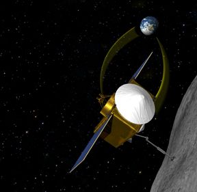
OSIRIS-REx (OSIRIS-REx)
OSIRIS-REx (Origins, Spectral Interpretation, Resource Identification, Security--Regolith Explorer) launched September 8, 2016. It explored the Near Earth Asteroid (101955) Bennu in detail including with the Goddard-built OVIRS instrument. OSIRIS-REx collected a sample in October 2020 and returned it to Earth on September 24, 2023. This sample will help us investigate planet formation and the origin of life, and the data collected at the asteroid will also aid our understanding of asteroids that can impact Earth (Bennu is a potentially hazardous object with a 1-in-2,700 chance of impacting Earth between the years 2175 and 2199). OSIRIS-REx is led by PI Dante Lauretta of the University of Arizona and managed by GSFC.
Key Staff
- Support Scientist: Sander Goossens
- Research Associate: Nancy Jones
- Science Collaborator: José Aponte
- Science Collaborator: Jamie Elsila Cook
- Research Associate: Erwan Mazarico
- Research Associate: Michael Callahan
- Research Associate: Brooke Hsu
- Research Associate: Lora Bleacher
- Research Associate: Jamie Elsila Cook
- Program Scientist: James Garvin
- Co Investigator: Dennis Reuter
- Co Investigator: Amy Simon
- Co Investigator: David Rowlands
- Co Investigator: Gregory Neumann
- Co Investigator: Daniel Glavin (he/him)
- Co Investigator: Hannah Kaplan
- Co Investigator: Lucy Lim
- Project Scientist: Jason Dworkin
- Deputy Project Scientist: Joseph Nuth
- Instrument Scientist: Dennis Reuter
- Instrument Scientist: Amy Simon
OSIRIS-REx Visible and Infrared Spectrometer (OVIRS)
In addition to providing project management for the OSIRIS-REx mission, Goddard Space Flight Center will build one of the spacecraft's principal instruments, the Visible and Infrared Spectrometer (OVIRS).
Key Staff
- Data Processing Team Member: Allen Lunsford
- Data Processing Team Member: Nicolas Gorius
- Co Investigator: David Rowlands
- Instrument Scientist: Dennis Reuter
- Instrument Scientist: Amy Simon
- Instrument Scientist: Allen Lunsford
Satellite Laser Ranging (SLR)
Satellite Laser Ranging (SLR) is a fundamental measurement technique used by the NASA Space Geodesy Program to support both national and international programs in Earth dynamics, ocean and ice surface altimetry, navigation and positioning, and technology development. NASA continues to maintain and operate five trailer-based Mobile Laser Ranging Stations (MOBLAS) and two compact Transportable Laser Ranging Systems (TLRS) at fixed sites.
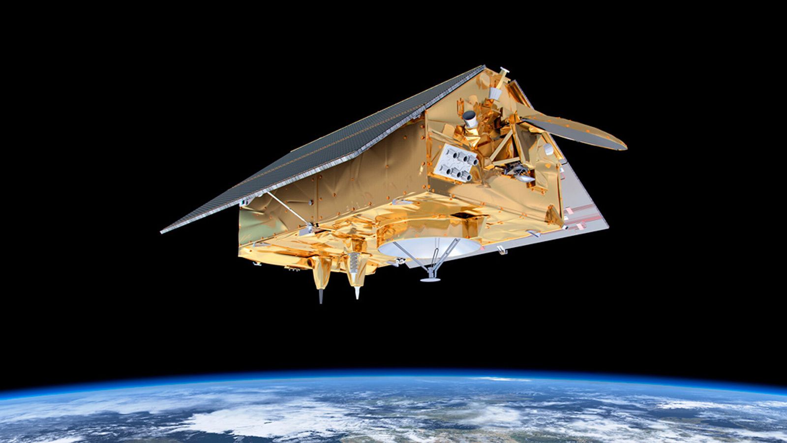
Sentinel-6A/Michael Freilich (Sentinel-6A)
The Sentinel-6 Michael Freilich radar altimeter mission (NASA/CNES/NOAA/EUMETSAT/ESA/EU Copernicus), has the objective of providing high-precision measurements of global sea-level from 2020–2030.
Key Staff
Space Geodesy Project (SGP)
The goal of the NASA Space Geodesy Project (SGP) is to build, deploy, and operate a next generation NASA Space Geodetic Network of integrated, multi-technique next generation space geodetic observing systems. This new NSGN will serve as NASA’s contribution to a global network designed to produce data required to maintain the Terrestrial Reference Frame and provide other data necessary for fully realizing the measurement potential of the current and coming generation of Earth Observing spacecraft.
SGP is part of the Earth Science Decadal and the National Research Council study "Precise Geodetic Infrastructure." It is a Goddard/JPL partnership with participation from the Smithsonian Astrophysical Observatory
and the University of Maryland.
Key Staff
- Project Manager: Stephen Merkowitz
- Project Scientist: Frank Lemoine
- Instrument Scientist: Leonid Petrov
- Instrument Scientist: Evan Hoffman
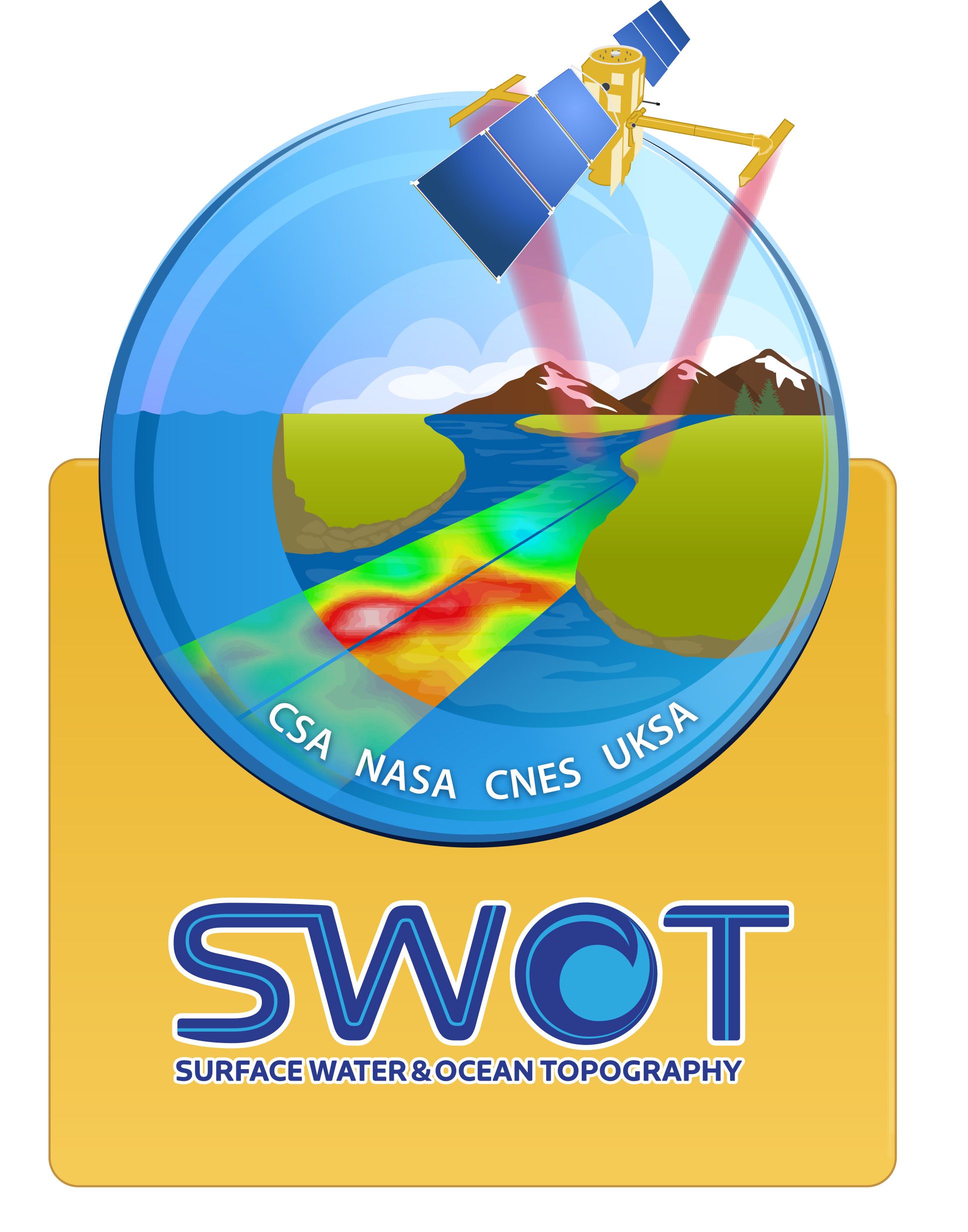
Surface Water Ocean Topography (SWOT)
The Surface Water and Ocean Topography (SWOT) mission is NASA's first global survey of Earth's surface water. Using state-of-the-art "radar interferometry" technology to measure the elevation of water, SWOT will observe major lakes, rivers and wetlands while detecting ocean features with unprecedented resolution. SWOT data will provide critical information that is needed to assess water resources on land, track regional sea level changes, monitor coastal processes, and observe small-scale ocean currents and eddies.
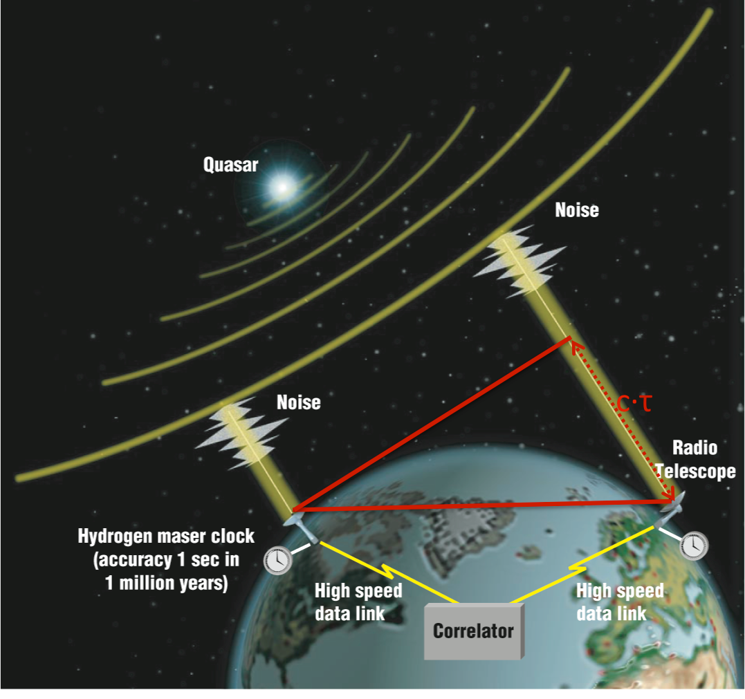
Very Long Baseline Interferometry (VLBI)
Over its 40-year history of development and operation, the space geodetic technique called very long baseline interferometry (VLBI) has provided an unprecedented record of the motions of the solid Earth. VLBI is unique in its ability to define an inertial reference frame and to measure the Earth's orientation in this frame.