Missions & Projects
Alphabetical
By Last Name:
Displaying records 1 to 24 of 77.
Show:
Advanced Topographic Laser Altimeter System (ATLAS)
ICESat-2 carries a single instrument – the Advanced Topographic Laser Altimeter System, or ATLAS. Like the altimeter on the first ICESat mission, ATLAS measures the travel times of laser pulses to calculate the distance between the spacecraft and Earth’s surface. ATLAS features new technologies that allow it to collect a more detailed, precise picture of the heights of the planet’s ice, vegetation, land surface, water and clouds. As it orbits over the poles, ATLAS has three major tasks: Send pulses of laser light to the ground, collect the returning photons in a telescope, and record the photon travel time.
AErosol RObotic NETwork (AERONET)
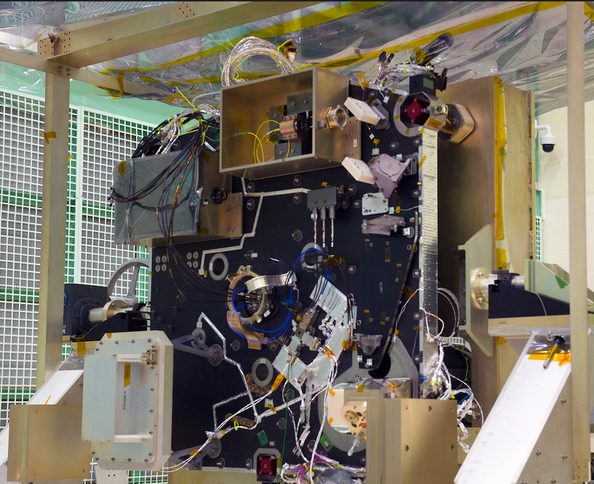
The AERONET (AErosol RObotic NETwork) program is a federation of ground-based remote sensing aerosol networks established by NASA and PHOTONS (PHOtométrie pour le Traitement Opérationnel de Normalisation Satellitaire; Univ. of Lille 1, CNES, and CNRS-INSU) and is greatly expanded by networks (e.g., RIMA, AeroSpan, AEROCAN, and CARSNET) and collaborators from national agencies, institutes, universities, individual scientists, and partners. The program provides a long-term, continuous and readily accessible public domain database of aerosol optical, microphysical and radiative properties for aerosol research and characterization, validation of satellite retrievals, and synergism with other databases. The network imposes standardization of instruments, calibration, processing and distribution.
Airborne Earth Science Microwave Imaging Radiometer (AESMIR)
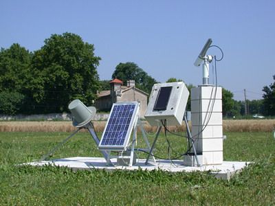
The Airborne Earth Science Microwave Imaging Radiometer (AESMIR) is a passive microwave airborne imager covering the 6-100 GHz bands that are essential for observing key Earth System elements such as precipitation, snow, soil moisture, ocean winds, sea ice, sea surface temperature, vegetation, etc.
Airborne Validation Unified Experiment: Land to Ocean (AVUELO)
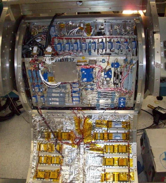
The Airborne Validation Unified Experiment: Land to Ocean (AVUELO) is a partnership between NASA, the Smithsonian Institution’s Tropical Research Institute, and the Costa Rican Fisheries Federation, as well as universities and institutes in the United States and Panama. AVUELO’s goal is to calibrate a new class of space-borne imagers for tropical vegetation and oceans research.

Apache Point Observatory
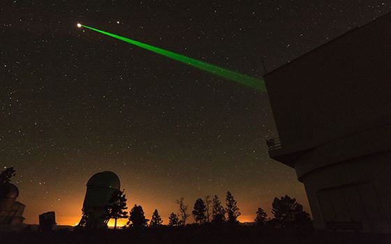
The Apache Point Lunar Laser Ranging Station utilizes the Astrophysical Research Consortium 3.5-meter telescope at the Apache Point Observatory in Sunspot, New Mexico. The large collecting area of the Apache Point 3.5 m diameter telescope, good atmospheric conditions at the site, and the efficient avalanche photodiode arrays used by the station result in a high-detection rate (even multiple detections per laser pulse) leading to millimeter-level range precision.
Key Staff
- Research Associate: Vishnu Viswanathan
- Research Associate: Nicholas Colmenares
- Project Manager: Stephen Merkowitz
- Instrument Scientist: Evan Hoffman
Aqua
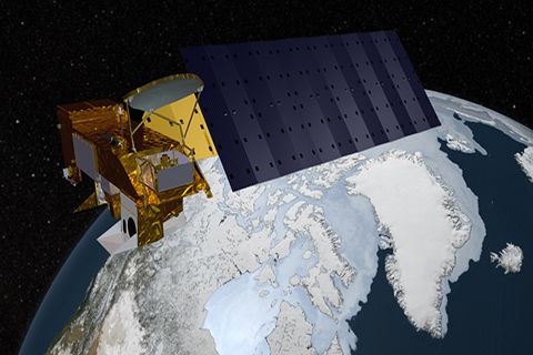
Aqua, Latin for water, is a NASA satellite mission designed to collect information about Earth's water cycle and other aspects of the Earth system. Aqua's six instruments collect a variety of global data on ocean evaporation, atmospheric water vapor, clouds, precipitation, soil moisture, sea ice, land ice, and snow cover on the land and ice. Additional variables that Aqua measures include radiative energy fluxes; aerosols; vegetation cover on the land; phytoplankton and dissolved organic matter in the oceans; and air, land, and water temperatures. Aqua was launched on May 4, 2002.
Key Staff
- Project Scientist: Lazaros Oreopoulos
- Deputy Project Scientist: Linette Boisvert
- Instrument Principal Investigator: Miguel Román
Arctic- Boreal Vulnerability Experiment (ABoVE)
Climate change in the Arctic and Boreal region is unfolding faster than anywhere else on Earth, resulting in reduced Arctic sea ice, thawing of permafrost soils, decomposition of long- frozen organic matter, widespread changes to lakes, rivers, coastlines, and alterations of ecosystem structure and function. NASA's Terrestrial Ecology Program is conducting a major field campaign, the Arctic-Boreal Vulnerability Experiment (ABoVE), in Alaska and western Canada, for 8 to 10 years, starting in 2015. ABoVE seeks a better understanding of the vulnerability and resilience of ecosystems and society to this changing environment.

Blueflux
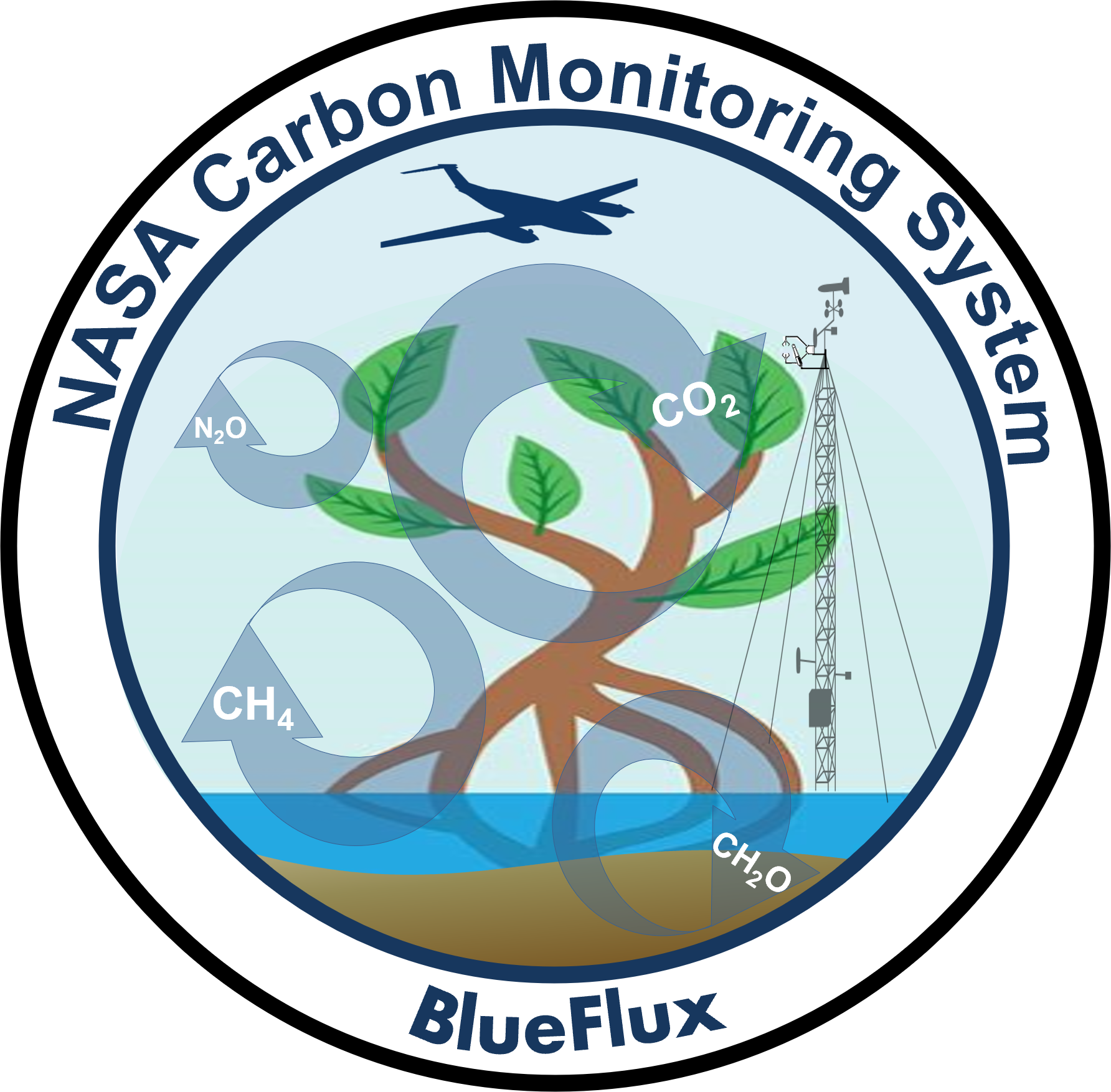
BlueFlux is supported by the NASA Carbon Monitoring System to measure fluxes of carbon dioxide and methane emissions over blue carbon ecosystems. The measurements are made using chambers, flux towers and aircraft flux instruments, including the CARbon Flux Experiment (CARAFE) payload. The data products will be used by local stakeholders to support mangrove and sawgrass restoration for carbon sequestration.
Key Staff
- Principal Investigator: BENJAMIN POULTER
- Co Investigator: Lola Fatoyinbo
- Co Investigator: Glenn Wolfe
Clouds and the Earth’s Radiant Energy System (CERES)
The Clouds and the Earth’s Radiant Energy System (CERES) project provides satellite-based observations of ERB and clouds. It uses measurements from CERES instruments flying on several satellites along with data from many other instruments to produce a comprehensive set of ERB data products for climate, weather and applied science research.
Combined Radar/Radiometer Instrument System (ComRAD)
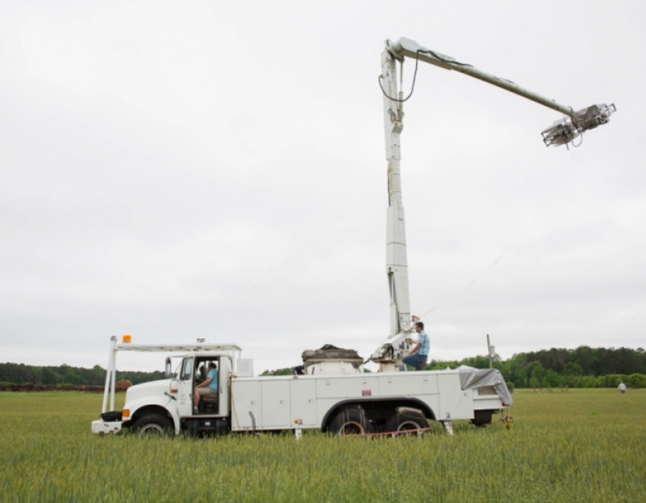
The Combined Radar/Radiometer (ComRAD) is a ground-based microwave instrument system mounted on a 19-m hydraulic boom truck. This instrument package is an outgrowth of a network analyzer-based L, C, and X band polarimetric radar system developed jointly by NASA/GSFC and George Washington University which has provided reliable calibrated radar data in soil moisture field campaigns across the United States since the early 1990s.
Compact Optical Profiling System (C-OPS)
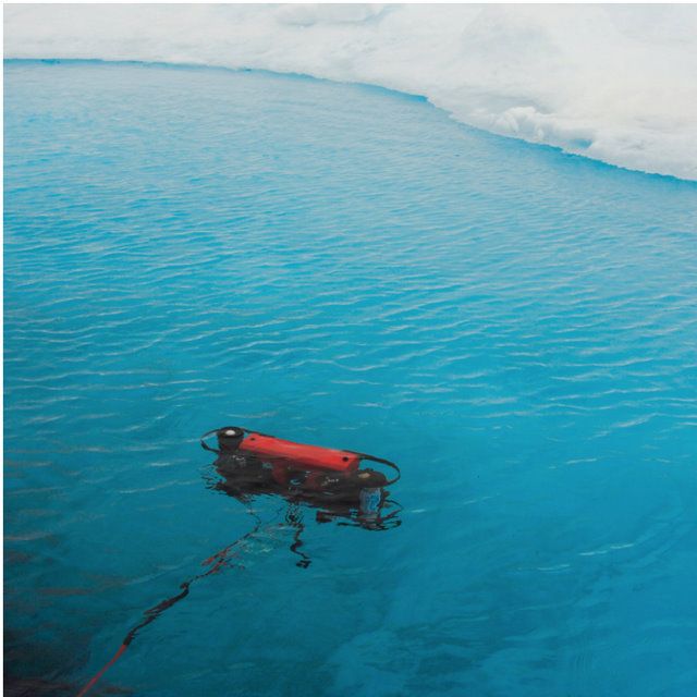
The C-OPS instrument is a culmination of several new technologies, each focused on different aspects of resolving the optical complexity of the near-shore water column. Although C-OPS represents a significant improvement over legacy profilers, it was designed from inception specifically to operate in shallow coastal waters and from a wide variety of platforms ranging from offshore towers, small boats, and ocean-class research vessels. Electronically, the system is self-organizing; when initially powered, the aggregator queries each instrument to determine the optimal power required for operation over the existing length of the cables and the population of detectors available to the configuration.
Crustal Dynamics Data Information System (CDDIS)
The Crustal Dynamics Data Information System (CDDIS) is NASA’s public, active archive of space geodesy data, derived products, and related information. The CDDIS is funded by NASA but cooperates extensively with the international community in support of Earth science research. The CDDIS supports a large international community of geodesy, solid Earth, and natural hazards researchers by providing timely access to the contents of its archive. The archive includes Global Navigation Satellite System (GNSS), Satellite Laser Ranging (SLR), Very Long Baseline Interferometry (VLBI), and Doppler Orbitography and Radiopositioning Integrated by Satellite (DORIS) data as well as products derived from these data. The CDDIS is one of NASA’s Earth Observing System Data and Information System (EOSDIS) Distributed Active Archive Centers (DAACs). All data, products, and information are online and openly available through anonymous ftp and web access.

Current State of Sea Ice Cover
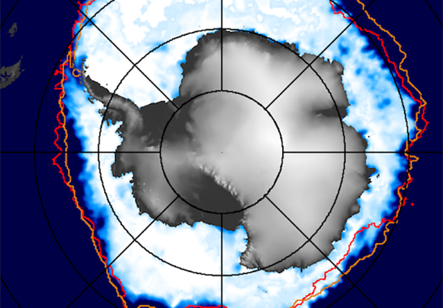
Up-to-date satellite observations of the sea ice covers of both the Arctic and the Antarctic, along with comparisons with the historical satellite record of more than 4 decades.
Cyanobacteria Assessment Network (CyAN)
CyAN is a collaborative project among EPA; the National Aeronautics and Space Administration (NASA); the National Oceanic and Atmospheric Administration (NOAA); the United States Geological Survey (USGS); and, as of 2023, the U.S. Army Corps of Engineers (USACE) to develop an early warning indicator system to detect algal blooms in U.S. freshwater systems.

Distributed Biological Observatory (DBO)
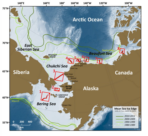
Distributed Biological Observatory (DBO) is a multi-agency program in support of the NOAA Arctic Research Program. Here we present data imagery and animations displaying recent chlorophyll pigment concentration, sea surface temperatures, sea ice concentration, cloud fraction, wind vectors, and sea level pressure.
Doppler Orbitography by Radiopositioning Integrated on Satellite (DORIS)
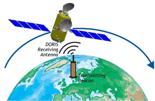
The Doppler Orbitography by Radiopositioning Integrated on Satellite (DORIS) was developed in France by the Centre National d'Etudes Spatiales (CNES) with the cooperation of Groupe de Recherche en Géodésie Spatiale (GRGS) and the Institut Géographique National (IGN).
Earth Information System (EIS)
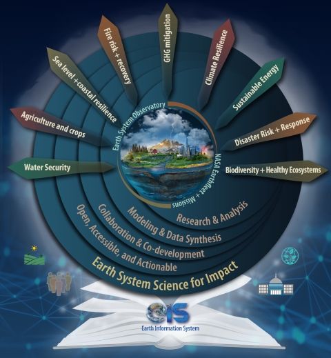
The Earth Information System (EIS) is a transdisciplinary, collaborative research and applications activity that combines NASA's satellite observations with modeling capabilities to produce new, integrated information enabled by emerging technology.
ECOsystem Spaceborne Thermal Radiometer Experiment on Space Station (ECOSTRESS)
The ECOSTRESS mission is accurately measuring the temperature of plants on Earth. Plants regulate their temperature by releasing water through tiny pores on their leaves called stomata. If they have sufficient water they can maintain their temperature, but if there is insufficient water, their temperatures rise and this temperature rise can be measured with ECOSTRESS. The images acquired by ECOSTRESS are the most detailed temperature images of the surface ever acquired from space and can be used to measure the temperature of an individual farmers field.

Ecosystems Synthetic Aperture Radar (EcoSAR)
EcoSAR is an advanced airborne polarimetric and interferometric P-band SAR instrument in development at NASA’s Goddard Space Flight Center through NASA’s Earth Science Technology Office Instrument Incubator Program (ESTO IIP).

Geostationary Ocean Color Imager (GOCI)
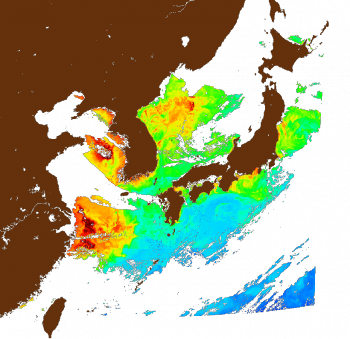
The Geostationary Ocean Color Imager (GOCI) is one of the three payloads onboard the Communication, Ocean and Meteorological Satellite (COMS). It acquires data in 8 spectral bands (6 visible, 2 NIR) with a spatial resolution of about 500 m over the Korean sea. The ocean data products that can be derived from the measurements are mainly the chlorophyll concentration, the optical diffuse attenuation coefficients, the concentration of dissolved organic material or yellow substance, and the concentration of suspended particles in the near-surface zone of the sea. In operational oceanography, satellite derived data products are used in conjunction with numerical models and in situ measurements to provide forecasting and now casting of the ocean state. Such information is of genuine interest for many categories of users.
