Earth
Earth
The only known planet with large amounts of surface liquid water, leading to
diverse life. The Earth is the largest of the terrestrial planets and the most
geologically active planet in the solar system with plate tectonics recycling
large portions of the crust over time.
Credit:(Gemini 4, S65-34658)
The complex atmospheric weather systems
are influenced by the oceans, polar caps, and geographic terrain. Its single
moon is thought to have been formed four and a half billion years ago in a giant
collision with the still-forming Earth.
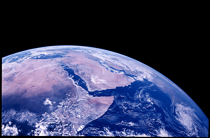
Apollo 17 hand-held Hasselblad photograph of northeast Africa and Saudi Arabia. This oblique view of Earth looking north shows the Gulf of Suez, Dead Sea, Gulf of Aden, Persian Gulf and Gulf of Oman around Saudi Arabia, and Egypt, Sudan and Ethiopia in Africa. The Mediterranean is visible at upper left, and India can be made out at the right.
Credit: (Apollo 17, AS17-148-22718)
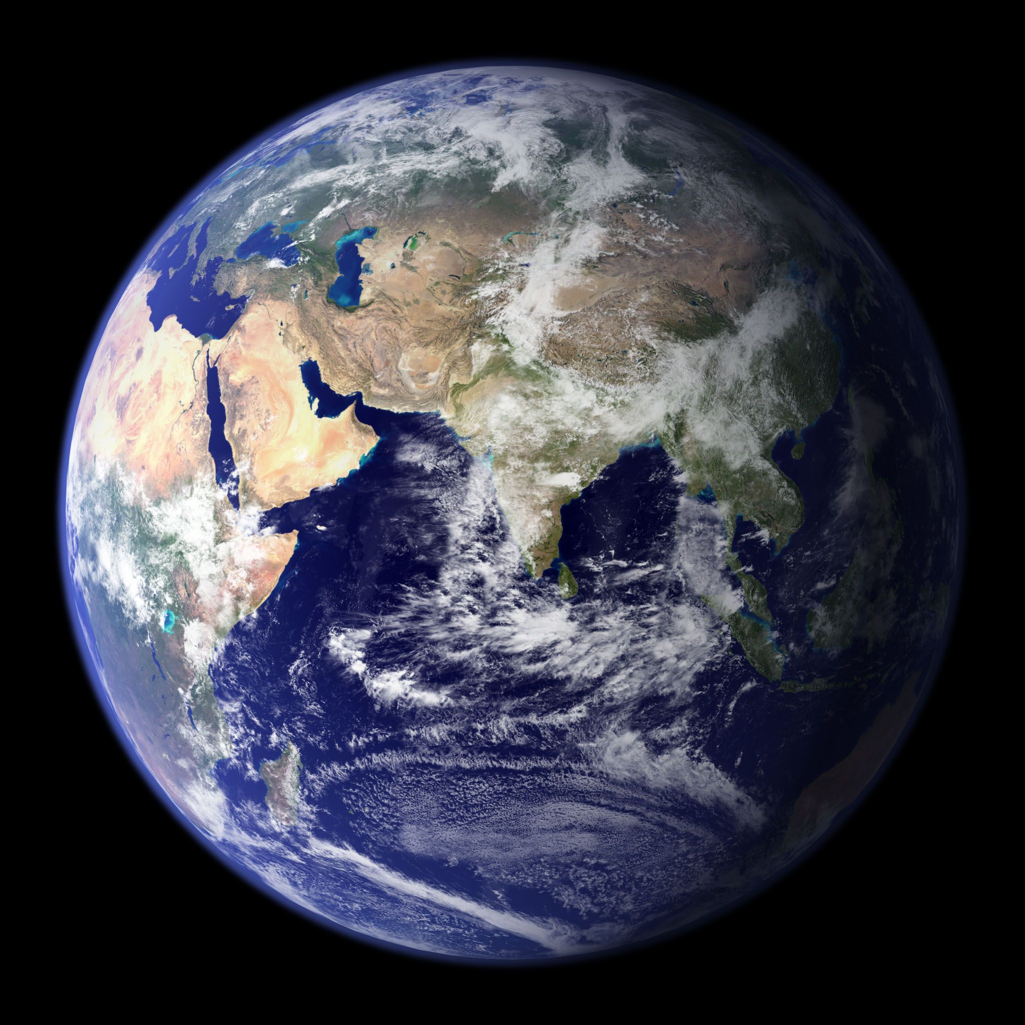
This spectacular "blue marble" image is the most detailed true-color image of the entire Earth to date. Using a collection of satellite-based observations, scientists and visualizers stitched together months of observations of the land surface, oceans, sea ice, and clouds into a seamless, true-color mosaic of every square kilometer (.386 square mile) of our planet.
Credit: (Goddard Space Flight Center Image by Reto Stöckli (land surface, shallow water, clouds). Enhancements by Robert Simmon (ocean color, compositing, 3D globes, animation).
Fun Facts
- Earth is the only planet with a significant proportion of oxygen in its atmosphere.
- Earth has the most powerful magnetic field of any terrestrial planet, which helps protect the atmosphere and surface from the space environment.
- Life exists in almost every available niche on Earth, from deep underground to the
high atmosphere, from superheated underwater vents to freezing antarctic ice sheets,
and from thick chemical brines to dry barren deserts.
Missions - Still Operating (Launch Year)
ACRIMSAT (1999)
Aqua (2002)
Aura (2004)
CALIPSO (2006)
CloudSat (2006)
DISCOVER-AQ (2011)
Earth Observing-1 (NMP) (2000)
GOES I - M (1994)
GRACE (2002)
Jason-1 (2001)
LAGEOS 1&2 (1976)
Landsat 7 (1999)
NOAA-N (2005)
Operation Ice Bridge (2009)
OSTM (2008)
QuikSCAT (1999)
SeaStar (SeaWiFS) (1997)
SeaWinds (ADEOS II) (2002)
SORCE (2003)
Terra (1999)
TRMM (1997)