Innovation Lab Use Case
Enhanced Very-high Resolution (EVHR) and SR-Lite
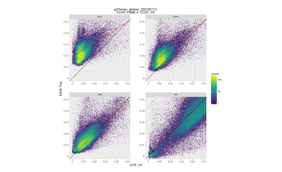
The EVHR project uses a high-end computing environment to produce top-of-atmosphere (TOA) reflectance and digital elevation models (DEM). The DEM outputs can be used to understand topographic effects or in conjunction with other products to understand tree canopy heights. The TOA outputs are orthorectified geotiffs that can be used in downstream processes with limited additional processing.
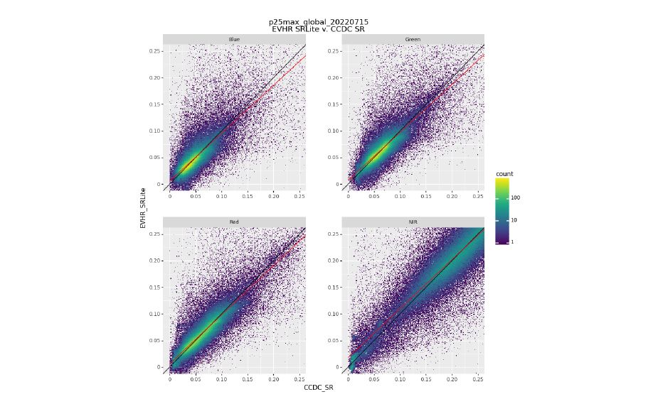
Surface Reflectance – lite (SR-lite) is an extension of EVHR that takes the orthorectified TOAs and uses Landsat Continuous Change Detection Classification (CCDC) to generate a pseudo surface reflectance product that helps to minimize the atmospheric effects on the Maxar data. The goal of EVHR and SR-lite is to make the Maxar data more analysis ready.