Missions & Projects
Featured
Alphabetical
By Last Name:
Displaying records 1 to 24 of 29.
Show:
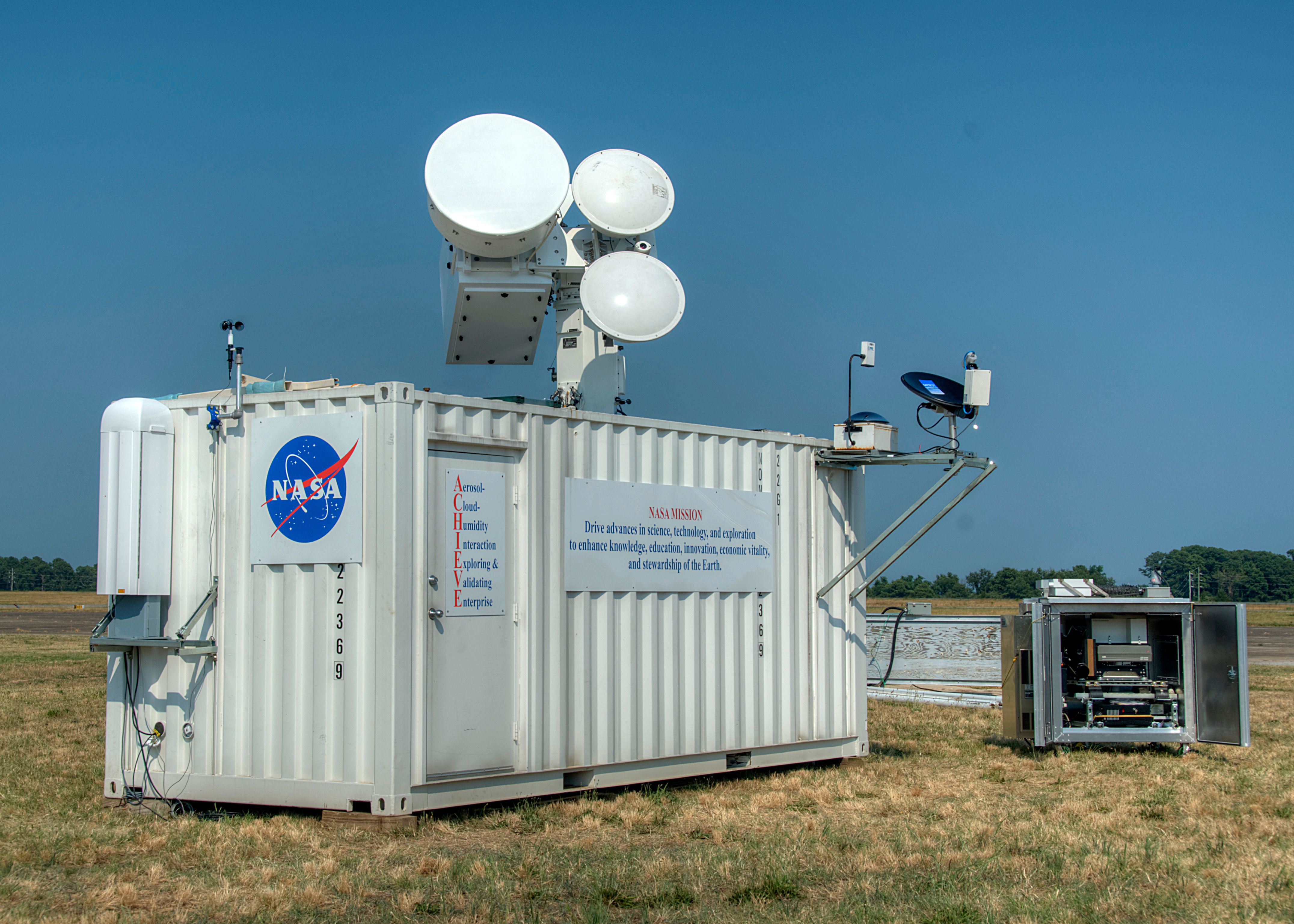
Aerosol, Cloud, Humidity, Interactions Exploring and Validating Enterprise (ACHIEVE)
Accurate retrievals of aerosol and cloud properties from space-borne sensors have been achieved with certain degrees of confidence. One of the most difficult tasks remaining to be resolved is when aerosols and clouds co-exist and interact with each other.
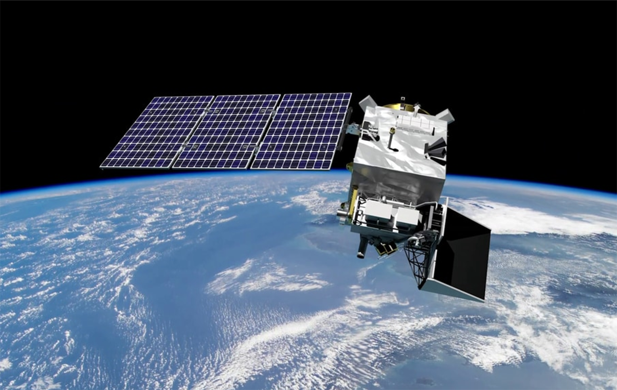
Aqua
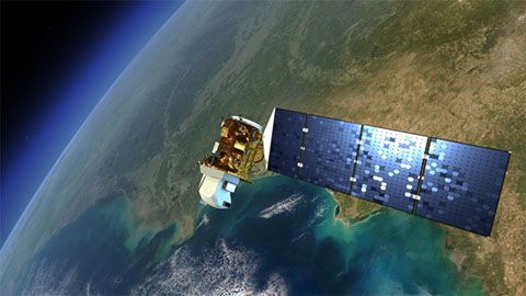
Aqua, Latin for water, is a NASA satellite mission designed to collect information about Earth's water cycle and other aspects of the Earth system. Aqua's six instruments collect a variety of global data on ocean evaporation, atmospheric water vapor, clouds, precipitation, soil moisture, sea ice, land ice, and snow cover on the land and ice. Additional variables that Aqua measures include radiative energy fluxes; aerosols; vegetation cover on the land; phytoplankton and dissolved organic matter in the oceans; and air, land, and water temperatures. Aqua was launched on May 4, 2002.
Key Staff
- Project Scientist: Lazaros Oreopoulos
- Deputy Project Scientist: Linette Boisvert
Atmospheric Radiation Measurements (ARM)
The Atmospheric Radiation Measurement (ARM) user facility is a multi-laboratory, U.S. Department of Energy (DOE) scientific user facility, and a key contributor to national and international climate research efforts.
Atmospheric System Research (ASR DOE)
Atmospheric System Research is to advance understanding of the interactions among aerosols, clouds, precipitation, radiation, dynamics, and thermodynamics.
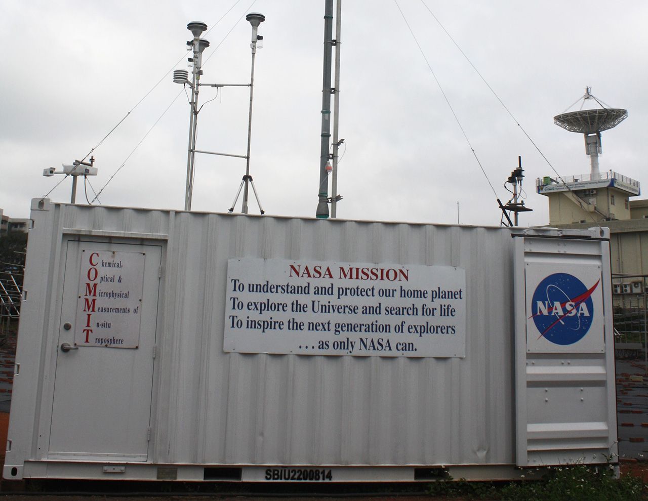
Chemical, Optical, and Microphysical Measurements of In-situ Troposphere (COMMIT)
Extending the success of the SMART mobile facility, COMMIT was built in 2006 as the companion in-situ observatory for studying basic chemical, optical and microphysical properties of atmospheric aerosols and trace gases.
Cloud Absorption Radiometer (CAR)
The Cloud Absorption Radiometer (CAR), considered the most frequently used airborne instrument built in-house at NASA's Goddard Space Flight Center, is capable of measuring scattered light by clouds in fourteen spectral bands. It is now managed by NASA's Ames Research Center.
Clouds and the Earth’s Radiant Energy System (CERES)
The Clouds and the Earth’s Radiant Energy System (CERES) project provides satellite-based observations of ERB and clouds. It uses measurements from CERES instruments flying on several satellites along with data from many other instruments to produce a comprehensive set of ERB data products for climate, weather and applied science research.
Continual Intercomparison of Radiation Codes (CIRC)
A reference source for GCM-type radiative transfer (RT) code evaluation. Contributes to the improvement of solar and thermal RT parameterizations.

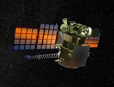
Deep Space Climate Observatory (DSCOVR)
DSCOVR, formerly called Triana, is the first Earth-observing satellite in an Lagrange-1 or L1 orbit. It supports a number of scientific instruments, including EPIC and NISTAR. EPIC (Earth Polychromatic Imaging Camera) is a 10-channel sepctroradiometer that provides daily 13 (in winter) or 22 (in summer) 10 narrow band spectral images of the entire sunlit face of Earth.
Earth Observatory
NASA's Earth Observatory is an interactive Web-based magazine where the science-attentive public can obtain new satellite imagery and scientific information about our home planet. The focus is on Earth's climatic and environmental change. The site is also designed to be useful to public media and educators. Any and all materials published on the Earth Observatory are freely available for re-publication, re-use, or re-broadcast (except in rare cases where copyright is indicated).
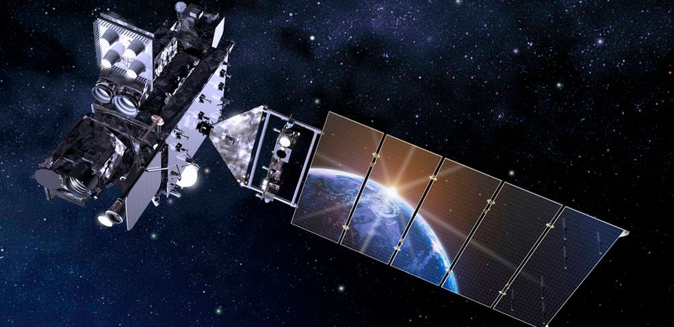
Geostationary Operational Environmental Satellite - R Series (GOES-R Series)
NOAA’s latest generation of Geostationary Operational Environmental Satellites (GOES), known as the GOES-R Series, is the nation’s most advanced fleet of geostationary weather satellites. The GOES-R Series significantly improves the detection and observation of environmental phenomena that directly affect public safety, protection of property and our nation’s economic health and prosperity.
The satellites provide advanced imaging with increased spatial resolution and faster coverage for more accurate forecasts, real-time mapping of lightning activity, and improved monitoring of solar activity and space weather.
The GOES-R Series is a four-satellite program (GOES-R (now 16)/S (now 17)/T (now 18)/U) that will extend the availability of the operational GOES satellite system through 2036.
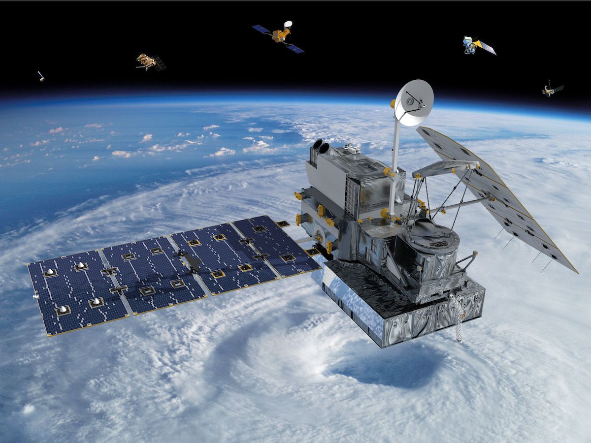
Global Precipitation Measurement (GPM)
The GPM mission is one of the next generation of satellite-based Earth science missions that study global precipitation (rain, snow, ice). GPM Constellation is a joint mission with the Japan Aerospace Exploration Agency (JAXA) and other international partners. Building upon the success of the Tropical Rainfall Measuring Mission (TRMM), it initiates the measurement of global precipitation, a key climate factor. Its science objectives are: to improve ongoing efforts to predict climate by providing near-global measurement of precipitation, its distribution, and physical processes; to improve the accuracy of weather and precipitation forecasts through more accurate measurement of rain rates and latent heating; and to provide more frequent and complete sampling of the Earth's precipitation. GPM was launched February 27, 2014.
Key Staff
- Formal Education Specialist: Dorian Janney
- RESEARCH SCIENTIST: Andrea Portier
- Project Scientist: George Huffman
- Deputy Project Scientist: Erich Stocker
- Deputy Project Scientist: David Wolff
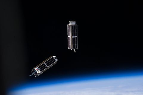
IceCube
IceCube is a 3U CubeSat funded by NASA for spaceflight demonstration of a commercial 883-GHz cloud radiometer. The satellite has produced the first global atmospheric ice map at the 883-Gigahertz band, an important frequency in the submillimeter wavelength for studying cloud ice and its effect on Earth’s climate. The IceCube team is a winner of the Robert H Goddard Exceptional Achievement Award for Engineering in 2019.
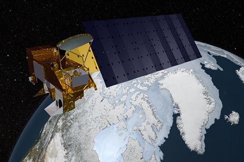
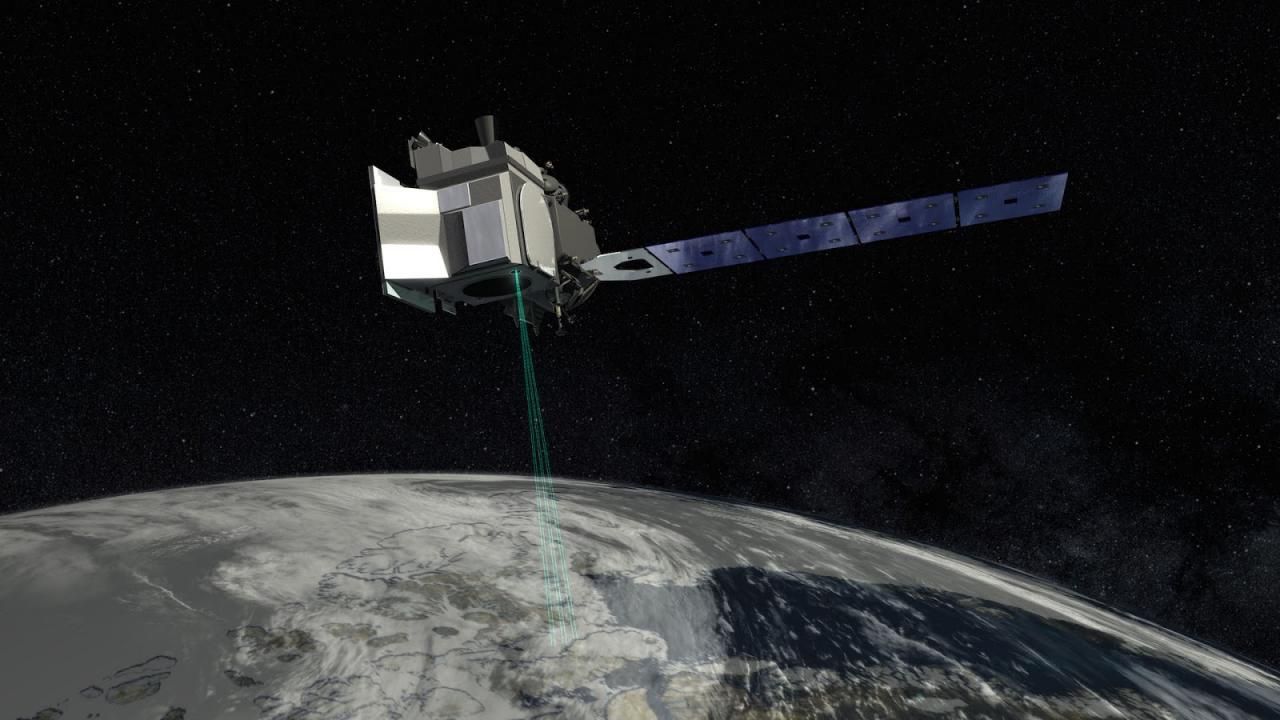
ICESat 2: Ice, Cloud, and Land Elevation Satellite 2 (ICESat-2)
The Ice, Cloud, and Land Elevation Satellite-2, or ICESat-2, measures the height of a changing Earth, one laser pulse at a time, 10,000 laser pulses a second. Launched September 15, 2018, ICESat-2 carries a photon-counting laser altimeter that allows scientists to measure the elevation of ice sheets, glaciers, sea ice and more - all in unprecedented detail.
Key Staff
- Support Scientist: Stephen Holland
- Receiver Algorithms Lead: Jan Mcgarry
- Senior Support Scientist: Scott Luthcke
- Calibration Team Member: Philip Dabney
- Sr. Test Systems Engineer: Henock Legesse
- Project Scientist: Thomas Neumann
- Deputy Project Scientist: Nathan Kurtz
- Instrument Scientist: Anthony Martino
IDS - The Global Aerosol System (IDS-AeroSys)
The project seeks to characterize the Global Aerosol System using a combination of satellite observations and chemical transport models. The end goal is to understand and quantify aerosol effects and aerosol forcing on global and regional climate.
Intercomparison of 3D Radiation Codes (I3RC)
The Intercomparison of 3D Radiation Codes (I3RC) is an ongoing project initiated in the late 1990s.
Landsat 8
Launched on February 11, 2013, Landsat 8 (formerly the Landsat Data Continuity Mission, LDCM) is collecting valuable data and imagery used in agriculture, education, business, science, and government.
The Landsat Program provides repetitive acquisition of high resolution multispectral data of the Earth’s surface on a global basis. The data from Landsat spacecraft constitute the longest record of the Earth’s continental surfaces as seen from space. It is a record unmatched in quality, detail, coverage, and value.
Key Staff
- Project Scientist: Christopher Neigh
- Deputy Project Scientist: Bruce Cook
- Instrument Scientist: Philip Dabney
Moderate Resolution Imaging Spectroradiometer (MODIS)
MODIS (or Moderate Resolution Imaging Spectroradiometer) is a key instrument aboard the Terra (originally known as EOS AM-1) and Aqua (originally known as EOS PM-1) satellites. Terra's orbit around the Earth is timed so that it passes from north to south across the equator in the morning, while Aqua passes south to north over the equator in the afternoon. Terra MODIS and Aqua MODIS are viewing the entire Earth's surface every 1 to 2 days, acquiring data in 36 spectral bands, or groups of wavelengths (see MODIS Technical Specifications). These data will improve our understanding of global dynamics and processes occurring on the land, in the oceans, and in the lower atmosphere. MODIS is playing a vital role in the development of validated, global, interactive Earth system models able to predict global change accurately enough to assist policy makers in making sound decisions concerning the protection of our environment.
Multi-angle Imaging SpectroRadiometer (MISR)
No instrument like MISR has flown in space before. Viewing the sunlit Earth simultaneously at nine widely spaced angles, MISR provides ongoing global coverage with high spatial detail. Its imagery is carefully calibrated to provide accurate measures of the brightness, contrast, and color of reflected sunlight.
MISR provides new types of information for scientists studying Earth's climate, such as the partitioning of energy and carbon between the land surface and the atmosphere, and the regional and global impacts of different types of atmospheric particles and clouds on climate. The change in reflection at different view angles affords the means to distinguish different types of atmospheric particles (aerosols), cloud forms, and land surface covers. Combined with stereoscopic techniques, this enables construction of 3-D models and estimation of the total amount of sunlight reflected by Earth's diverse environments.
Plankton, Aerosol, Cloud, ocean Ecosystem (PACE)
PACE is NASA's Plankton, Aerosol, Cloud, ocean Ecosystem mission. It launched on February 8, 2024, extending and improving NASA's over 20-year record of satellite observations of global ocean biology, aerosols (tiny particles suspended in the atmosphere), and clouds.
Key Staff
- Polarimeter Lead: Kirk Knobelspiesse
- Science Data Segment Manager: Bryan Franz
- Applications Coordinator: Erin Urquhart
- Science Data Segment Deputy Manager: Sean Bailey
- Project Scientist: Jeremy Werdell (he/him)
- Deputy Project Scientist: Brian Cairns
- Deputy Project Scientist: Antonio Mannino
- Instrument Scientist: Gerhard Meister
- Senior Scientist: Susanne Craig