Missions & Projects
Featured
Alphabetical
By Last Name:
Displaying records 1 to 24 of 170.
Show:
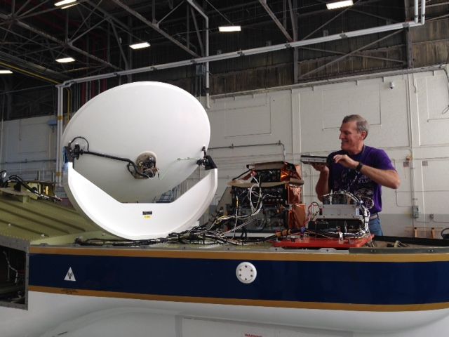
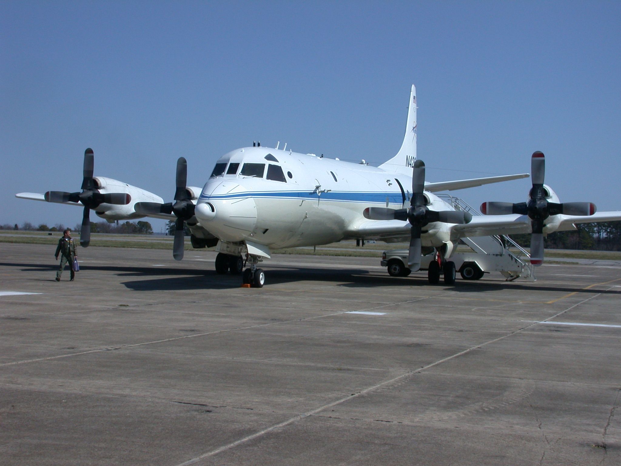
Advanced Topographic Laser Altimeter System (ATLAS)
ICESat-2 carries a single instrument – the Advanced Topographic Laser Altimeter System, or ATLAS. Like the altimeter on the first ICESat mission, ATLAS measures the travel times of laser pulses to calculate the distance between the spacecraft and Earth’s surface. ATLAS features new technologies that allow it to collect a more detailed, precise picture of the heights of the planet’s ice, vegetation, land surface, water and clouds. As it orbits over the poles, ATLAS has three major tasks: Send pulses of laser light to the ground, collect the returning photons in a telescope, and record the photon travel time.
Aeronomy of Ice in the Mesosphere (AIM)
The AIM satellite mission is designed to explore Polar Mesospheric Clouds (PMCs), also called noctilucent clouds, to find out why they form and why they are changing.
AErosol RObotic NETwork (AERONET)
The AERONET (AErosol RObotic NETwork) program is a federation of ground-based remote sensing aerosol networks established by NASA and PHOTONS (PHOtométrie pour le Traitement Opérationnel de Normalisation Satellitaire; Univ. of Lille 1, CNES, and CNRS-INSU) and is greatly expanded by networks (e.g., RIMA, AeroSpan, AEROCAN, and CARSNET) and collaborators from national agencies, institutes, universities, individual scientists, and partners. The program provides a long-term, continuous and readily accessible public domain database of aerosol optical, microphysical and radiative properties for aerosol research and characterization, validation of satellite retrievals, and synergism with other databases. The network imposes standardization of instruments, calibration, processing and distribution.
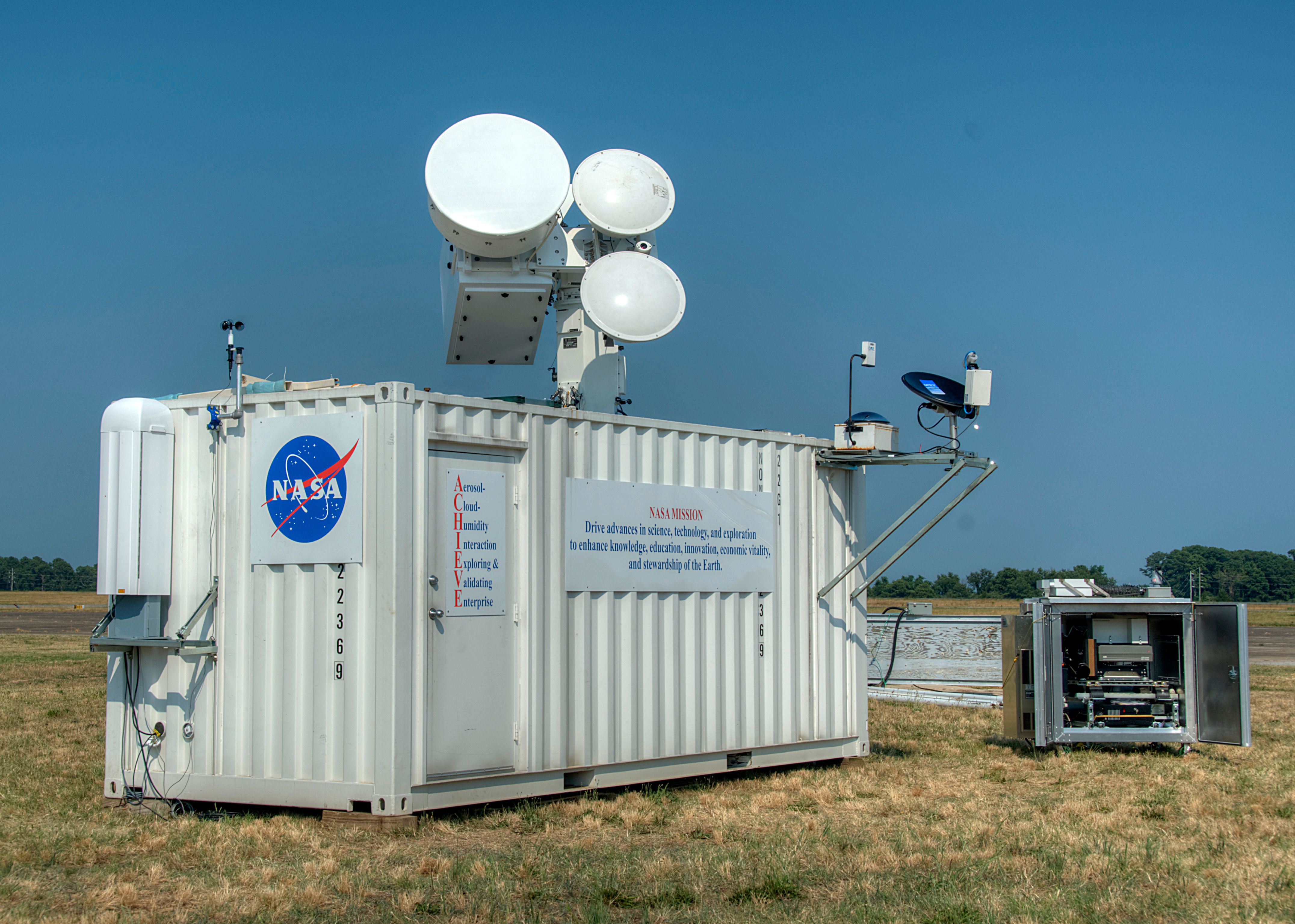
Aerosol, Cloud, Humidity, Interactions Exploring and Validating Enterprise (ACHIEVE)
Accurate retrievals of aerosol and cloud properties from space-borne sensors have been achieved with certain degrees of confidence. One of the most difficult tasks remaining to be resolved is when aerosols and clouds co-exist and interact with each other.
Airborne and Satellite Investigation of Asian Air Quality (ASIA-AQ)
The Airborne and Satellite Investigation of Asian Air Quality (ASIA-AQ) was an international cooperative investigation to study the factors contributing to local air quality across Asia. Measurements from ASIA-AQ were collected to validate aerosol satellite observations from South Korea’s Geostationary Environment Monitoring Spectrometer (GEMS), the upcoming Multi-Angle Imager for Aerosols (MAIA) mission, and other low-orbiting satellites. ASIA-AQ had one deployment from January to April 2024 across eastern Asia mainly targeting South Korea, Philippines, and Thailand.

Airborne Earth Science Microwave Imaging Radiometer (AESMIR)
The Airborne Earth Science Microwave Imaging Radiometer (AESMIR) is a passive microwave airborne imager covering the 6-100 GHz bands that are essential for observing key Earth System elements such as precipitation, snow, soil moisture, ocean winds, sea ice, sea surface temperature, vegetation, etc.
Airborne Validation Unified Experiment: Land to Ocean (AVUELO)
The Airborne Validation Unified Experiment: Land to Ocean (AVUELO) is a partnership between NASA, the Smithsonian Institution’s Tropical Research Institute, and the Costa Rican Fisheries Federation, as well as universities and institutes in the United States and Panama. AVUELO’s goal is to calibrate a new class of space-borne imagers for tropical vegetation and oceans research.
Apache Point Observatory
The Apache Point Lunar Laser Ranging Station utilizes the Astrophysical Research Consortium 3.5-meter telescope at the Apache Point Observatory in Sunspot, New Mexico. The large collecting area of the Apache Point 3.5 m diameter telescope, good atmospheric conditions at the site, and the efficient avalanche photodiode arrays used by the station result in a high-detection rate (even multiple detections per laser pulse) leading to millimeter-level range precision.
Key Staff
- Research Associate: Vishnu Viswanathan
- Research Associate: Nicholas Colmenares
- Project Manager: Stephen Merkowitz
- Instrument Scientist: Evan Hoffman
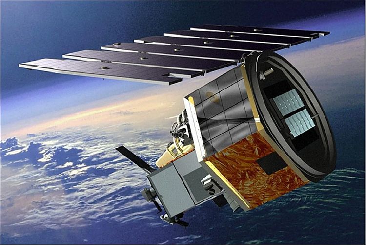
Aqua
Aqua, Latin for water, is a NASA satellite mission designed to collect information about Earth's water cycle and other aspects of the Earth system. Aqua's six instruments collect a variety of global data on ocean evaporation, atmospheric water vapor, clouds, precipitation, soil moisture, sea ice, land ice, and snow cover on the land and ice. Additional variables that Aqua measures include radiative energy fluxes; aerosols; vegetation cover on the land; phytoplankton and dissolved organic matter in the oceans; and air, land, and water temperatures. Aqua was launched on May 4, 2002.
Key Staff
- Project Scientist: Lazaros Oreopoulos
- Deputy Project Scientist: Linette Boisvert
- Instrument Principal Investigator: Miguel Román
Arctic- Boreal Vulnerability Experiment (ABoVE)
Climate change in the Arctic and Boreal region is unfolding faster than anywhere else on Earth, resulting in reduced Arctic sea ice, thawing of permafrost soils, decomposition of long- frozen organic matter, widespread changes to lakes, rivers, coastlines, and alterations of ecosystem structure and function. NASA's Terrestrial Ecology Program is conducting a major field campaign, the Arctic-Boreal Vulnerability Experiment (ABoVE), in Alaska and western Canada, for 8 to 10 years, starting in 2015. ABoVE seeks a better understanding of the vulnerability and resilience of ecosystems and society to this changing environment.

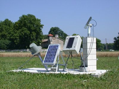
Atmospheric Lidar for Validation, Interagency Collaboration and Education (ALVICE)
ALVICE (Atmospheric Lidar for Validation, Interagency Collaboration and Education) is a ground based mobile lidar that is a roving transfer standard within the Network for the Detection for Atmospheric Composition Change (NDACC). The lidar measurements are water vapor mixing ratio, aerosol backscatter, extinction, depolarization, cloud liquid and ice water and rotational Raman temperature measurements. In addition to these lidar-based measurements additional equipment is carried in the trailer to provide balloon borne measurements (Vaisala RS-92 and Cryogenic Frostpoint hygrometer), surface reference measurements of pressure, temperature and RH as well as total column water using GPS.
Atmospheric Pressure Sounder
The long-term goal of this activity is to demonstrate the feasibility of a laser sounder instrument capable of measuring the surface-pressure field for the entire air column from satellite-to-ground with global coverage. The earth's surface pressure is a vital component of a variety of important scientific measurements, which are being undertaken at Goddard. Accurate knowledge of the surface pressure can enable calibration of 2-D measurements of CO2 content in the atmosphere and greatly improve the fidelity of surface water redistribution measurements from time-varying gravity fields. It is also important in weather prediction and atmospheric modeling.

Atmospheric Radiation Measurements (ARM)
The Atmospheric Radiation Measurement (ARM) user facility is a multi-laboratory, U.S. Department of Energy (DOE) scientific user facility, and a key contributor to national and international climate research efforts.
Atmospheric System Research (ASR DOE)
Atmospheric System Research is to advance understanding of the interactions among aerosols, clouds, precipitation, radiation, dynamics, and thermodynamics.
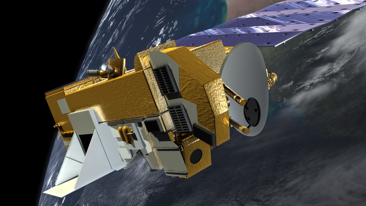
Aura
Aura (Latin for breeze) was launched July 15, 2004. Aura is part of the Earth Science Projects Division, a program dedicated to monitoring the complex interactions that affect the globe using NASA satellites and data systems. Aura's four instruments study the atmosphere's chemistry and dynamics. The satellite's measurements will enable scientists to investigate questions about ozone trends, air quality changes, and their linkage to climate change. Aura's measurements will provide accurate data for predictive models and provide useful information for local and national agency decision support systems.
Key Staff
- Project Scientist: Bryan Duncan
- Deputy Project Scientist: Nickolay Krotkov
- Facility Scientist: Joanna Joiner
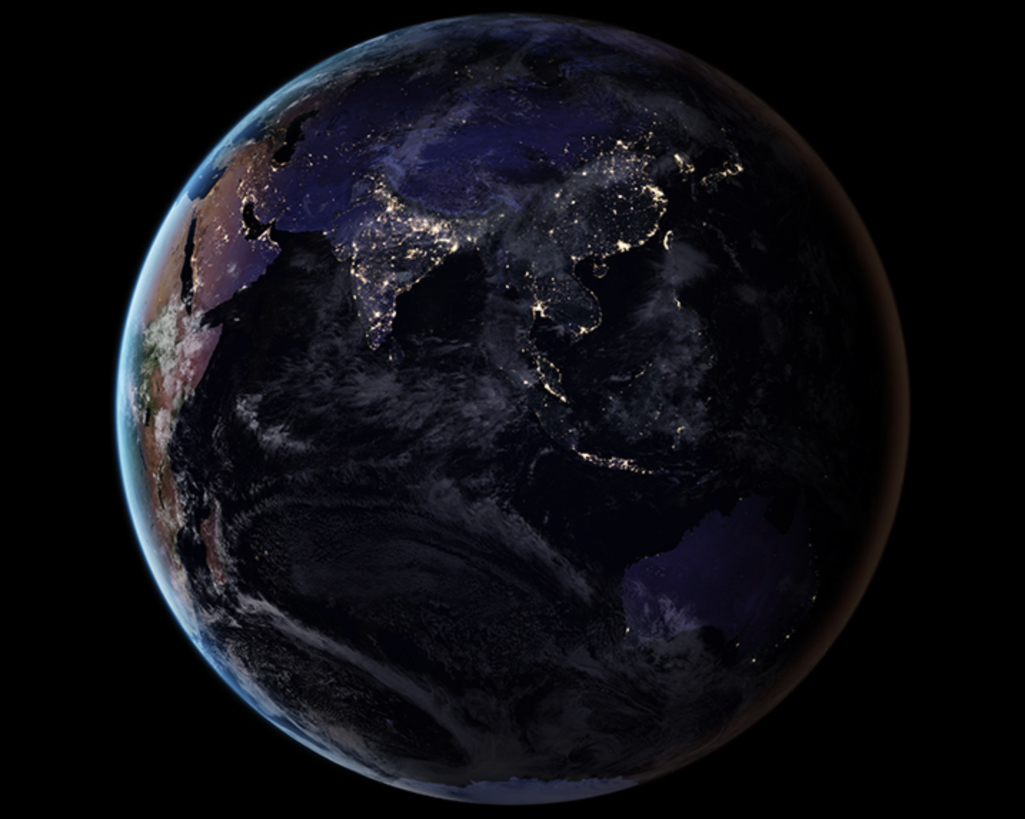
Black Marble
At night, satellite images of Earth capture a uniquely human signal--artificial lighting. Remotely-sensed lights at night provide a new data source for improving our understanding of interactions between human systems and the environment. NASA has developed the Black Marble, a daily calibrated, corrected, and validated product suite, so nightlight data can be used effectively for scientific observations. Black Marble is playing a vital role in research on light pollution, illegal fishing, fires, disaster impacts and recovery, and human settlements and associated energy infrastructures.
Blueflux
BlueFlux is supported by the NASA Carbon Monitoring System to measure fluxes of carbon dioxide and methane emissions over blue carbon ecosystems. The measurements are made using chambers, flux towers and aircraft flux instruments, including the CARbon Flux Experiment (CARAFE) payload. The data products will be used by local stakeholders to support mangrove and sawgrass restoration for carbon sequestration.
Key Staff
- Principal Investigator: BENJAMIN POULTER
- Co Investigator: Lola Fatoyinbo
- Co Investigator: Glenn Wolfe
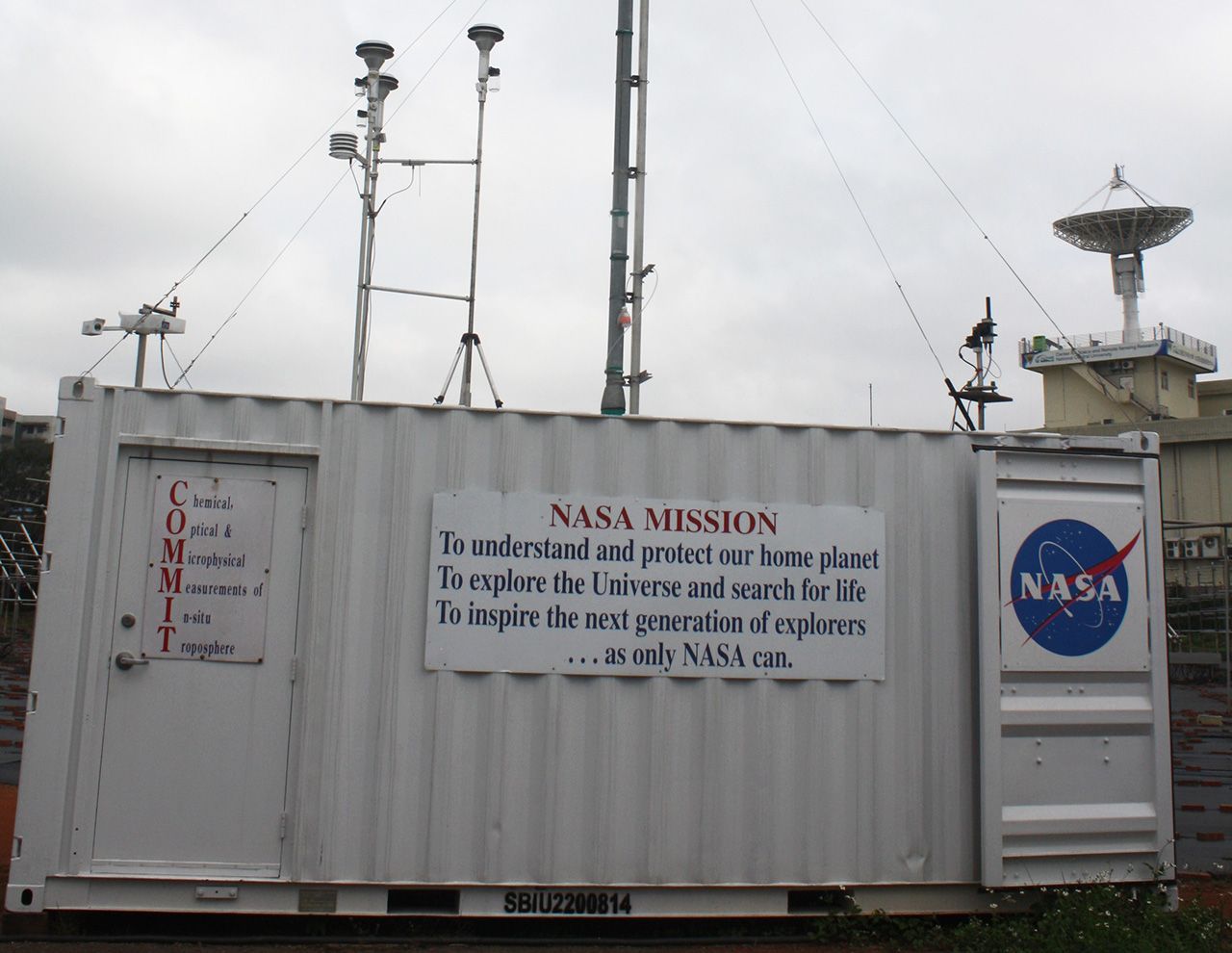
Chemical, Optical, and Microphysical Measurements of In-situ Troposphere (COMMIT)
Extending the success of the SMART mobile facility, COMMIT was built in 2006 as the companion in-situ observatory for studying basic chemical, optical and microphysical properties of atmospheric aerosols and trace gases.
Cloud Absorption Radiometer (CAR)
The Cloud Absorption Radiometer (CAR), considered the most frequently used airborne instrument built in-house at NASA's Goddard Space Flight Center, is capable of measuring scattered light by clouds in fourteen spectral bands. It is now managed by NASA's Ames Research Center.
Cloud Physics Lidar (CPL)
The Cloud Physics Lidar, or CPL, is a airborne backscatter lidar designed to operate simultaneously at three wavelengths: 1064, 532, and 355 nm. The CPL flies on high-altitude research aircraft, such as the ER-2 or WB-57. The purpose of the CPL is to provide multiwavelength measurements of cirrus, subvisual cirrus, and aerosols with high temporal and spatial resolution. The CPL utilizes state-of-art technology with a high repetition rate, low pulse energy laser and photon-counting detection. Vertical resolution of the CPL measurements is fixed at 30 m; horizontal resolution can vary but is typically about 200 m. From a fundamental measurement of 180-degree volume backscatter coefficients, various data products are derived, including time-height cross-section images; cloud and aerosol layer boundaries; optical depth for clouds, aerosol, and planetary boundary layer; and extinction profiles.